June 12, 2020: Latest Monthly and Seasonal Outlooks from the North American Multi-Model Ensemble Forecast and Chances for La Niña This Fall?
The latest outlooks for temperature and precipitation were released from the North American Multi-Model Ensemble this week. The outlooks include the monthly forecast for July as well as the seasonal forecast for Jul-Aug-Sep.
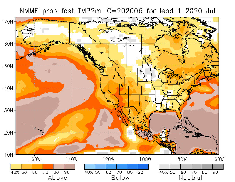
The monthly outlook maps are below. For temperature, a warmer than normal July is expected for a large part of the country. The odds are particularly good (70% or above) for parts of the Southwest.
July precipitation, as usual, is less certain, although, we see some enhanced odds of high than normal July precipitation in the Southern Plains, along the Gulf Coast, and parts of the East Coast.

Jul-Aug-Sep Season
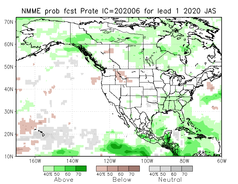
Somewhat similar to expectations for July, the seasonal outlook shows enhanced odds of a warmer than normal Jul-Aug-Sep. The odds are highest in parts of the Northern Plains, Intermountain West, and the West Coast/Pacific Northwest. Precipitation for Jul-Aug-Sep is more up in the air; however, the models are picking up on the possibility of reduced precipitation in Western Montana and Idaho while the Gulf and East Coast could continue their recent trend of enhanced precipitation through September.

La Niña in the Fall?
There is a good discussion over at NOAA’s ENSO Blog on the recent drop in sea-surface temperatures in the eastern tropical Pacific and what this could mean for the development of La Niña this fall. The upshot of the discussion is that most models are anticipating ENSO neutral conditions (no El Niño or La Niña) through the summer but then the models start diverging on what we could expect in the fall.
The models are basically split between the statistical models and the dynamical models. The statistical models essentially assess historical trends and how current conditions fit in the historical context. These models are forecasting ENSO neutral conditions this fall and could be picking up on the fact that we have never had a La Niña following an ENSO neutral winter, which is what occurred in 20019/2020. The consensus of the dynamical models, however, are predicting we could see La Niña developing sometime in the Aug-Sep-Oct timeframe. NOAA is therefore giving about equal odds of either an ENSO neutral or La Niña in the fall.
One more bit of evidence the NOAA folks brought up is that the recent drop in eastern tropical Pacific temperatures could be an early indication of a La Niña in the fall. They looked at the correlation between May sea-surface temperatures and the Niño 3.4 Index in the fall (the Niño 3.4 is one of the indices that are used to track El Niño or La Niña). Turns out May sea-surface temperatures are a pretty good indicator of what we could see in the fall. If that’s true, then we may have better than even odds of seeing a La Niña this fall.
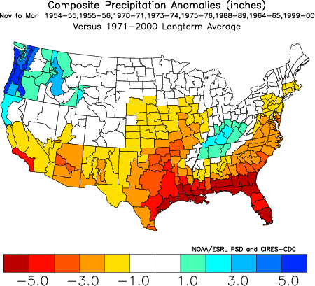
La Niña, or as some have termed it in the Southern Plains “La Nada” is not a particularly promising sign for fall and winter precipitation. The map below shows winter precipitation anomalies (difference from average) for La Nina going back to the 1950’s.

