
Keep updated on the latest weather trends and outlooks with Livestock Wx’s Weekly Update email. To subscribe, click here.
November 22, 2019: No El Niño, No La Niña So What’s Driving NOAA Outlooks?
It is becoming clear we are going to be in neutral ENSO conditions (i.e. no El Niño and La Niña) well into the spring of 2020. Our winter weather, therefore, will not have an ENSO signature, which means the winter forecast doesn’t have as much to lean on for predicting our winter weather.
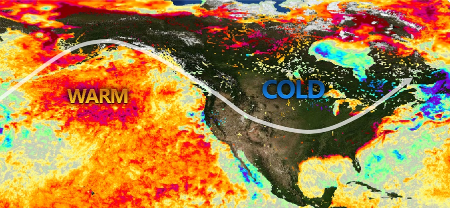
Unusually Warm North Pacific Water Persists
Even without an ENSO imprint, there is a persistent area of unusually warm water over the North Pacific, which could influence the position of the jet stream, and thereby short-term temperatures and precipitation. It’s possible that this jet stream pattern could emerge from time to time resulting in unusually mild coastal temperatures and an unusually cold middle U.S. The NOAA Outlooks, however, cannot pick up these episodic events and really focus more on the general trend of a given season. These sporadic events, though, can be very important as they can be acute drivers of stress to livestock.
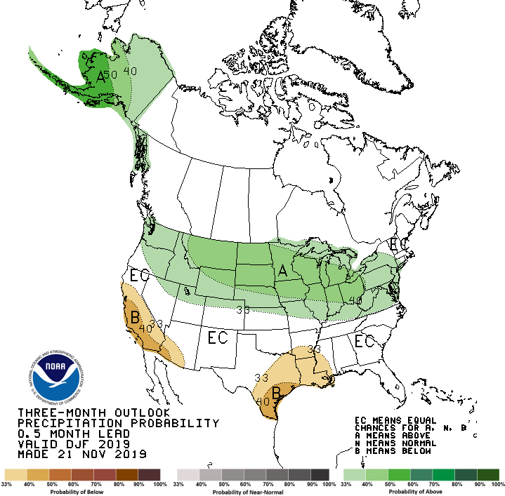
Dec-Jan-Feb Outlook
The new NOAA outlooks for the winter months of December-January-February calls for a cold and occasionally snowy late winter for sizeable parts of the Northern Plains, Midwest, and Great Lakes regions. Closer to home in the Southern Plains, the temperature outlook is favoring above-normal winter temperatures. Precipitation, however, has a slight tilt in the odds (33%-50%) for below-normal winter precipitation for the southeast portion of Texas and eastward to Louisiana, Arkansas, and Mississippi.
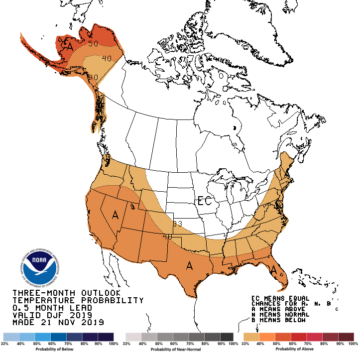
As we noted above, since El Niño or La Niña is unlikely to provide a major influence on our circulation patterns this winter, the NOAA outlooks are weighing more heavily the long-term climate trends in their forecasts. Over the last 30 years, winter temperatures have been warming for most of the U.S. For Texas and Oklahoma some of the largest increases have been seen in South Texas and Southwest and Central Oklahoma. Keep that in mind as you look at these winter outlooks. Current long-term trends can be very helpful but it doesn’t always translate to a slam-dunk forecast.