Keep updated on the latest weather trends and outlooks with Livestock Wx’s Weekly Update email. To subscribe, click here.
Dec. 20, 2019: Latest Outlooks Place Good Odds Remainder of Winter Will be Warmer Than Average for Southern Tier of U.S.
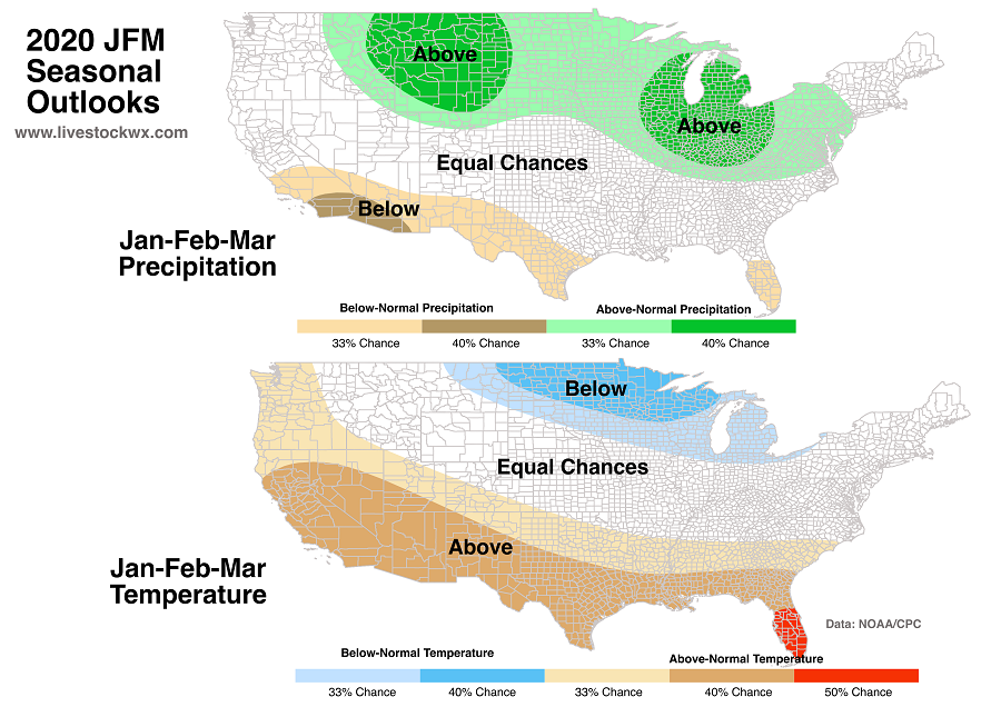
On Thursday, Dec. 19, NOAA released their seasonal outlooks for January-February-March. The outlooks indicate an increased chance of a cold and occasionally snowy winter for sizeable parts of the Northern Plains, Midwest, and Great Lakes regions.
For the Southwest and southern tier of the nation, there is an increased chance of above-normal temperatures.

Three Things Driving the Outlooks
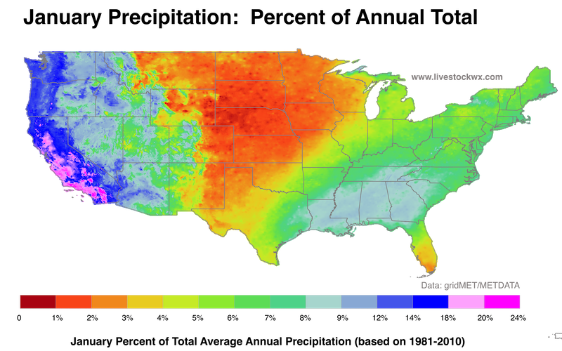
1) Winter Jet stream: From a climatological perspective, the contribution of precipitation in January to the total annual precipitation across the Great Plains and Midwest is pretty small. The image below shows the proportion of January precipitation to the total annual precipitation for the Contiguous U.S.

2) Nada Niño: ENSO neutral conditions (no El Niño or La Niña) are expected to persist well into the new year. The past weak El Niño has ended and should not have a significant impact on winter weather.
3) Warm North Pacific Ocean: A persistent area of unusually warm water over the North Pacific is likely to influence the position of the jet stream, and thereby the Jan-Feb-Mar temperature and precipitation patterns. It’s possible that this “wavy” jet stream pattern could emerge from time to time resulting in unusually mild coastal temperatures and an unusually cold middle U.S.
Atmospheric Rivers have been active so far this season resulting in heavy west coast precipitation in spots. These streams of highly focused moisture could continue into January.
We hope everyone has a Merry Christmas and a happy New Year. That’s all for Livestock Wx in 2019. We’ll be back, though, updating the forecast in a couple of weeks. See you again in 2020!
PO BOX 101988
FORT WORTH, TX 76185
1-800-242-7820
© 2023 Texas & Southwestern Cattle Raisers Association; All Rights Reserved.
