May 15, 2020
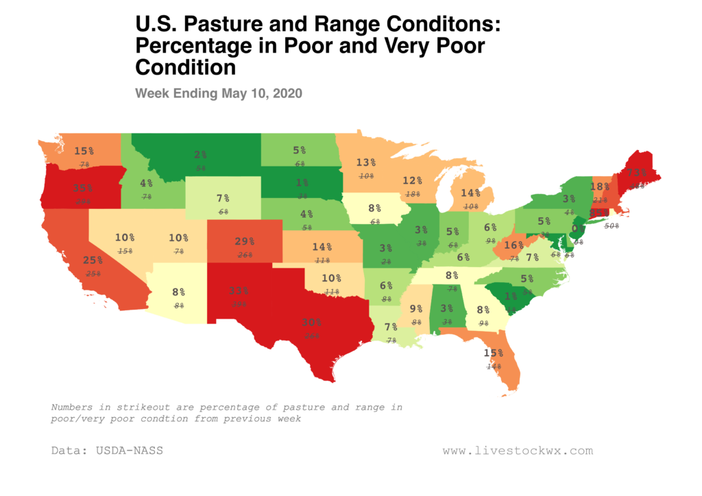
The latest Crop Progress report from USDA shows pasture and range conditions have declined in Texas and improved in Oklahoma (slightly) and New Mexico over the last week. The map below shows the percent area of pasture and range in poor or very poor condition. The number in strikeout is the previous week’s estimate.
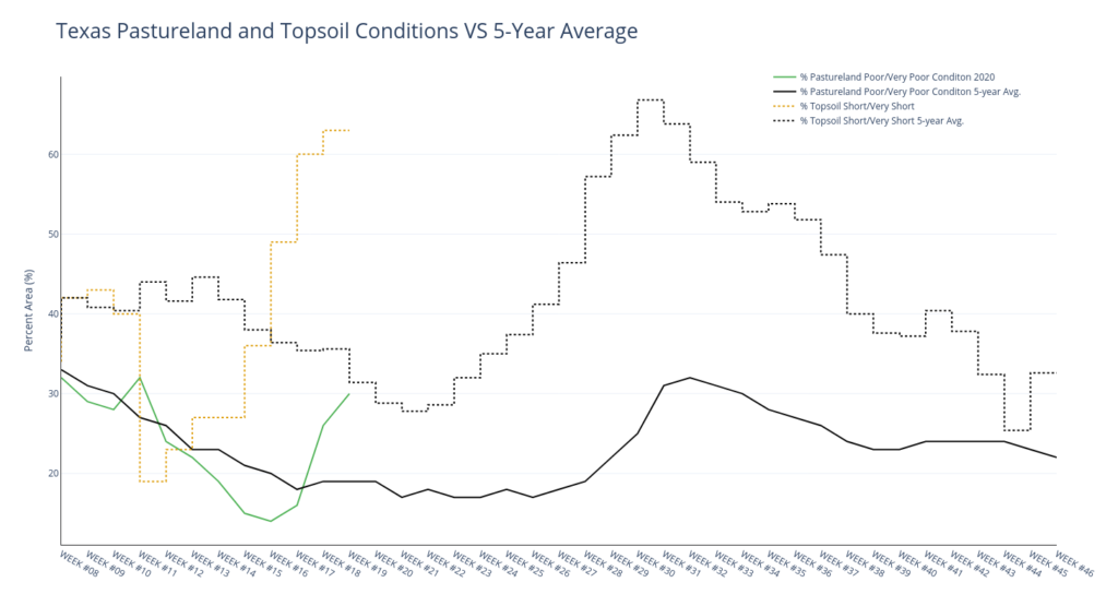
Just focusing on Texas and bringing in the status of topsoil moisture: the below chart shows the percentage of topsoil considered short and very short along with the pasture and range trend against the five-year average. As you can see, the percentage of topsoil in short/very short and the pasture and range in poor/very poor is a good bit higher that what we would normally expect for this time of year — at least over the last five-years. There have been some very wet years since 2015, though, so we probably shouldn’t get too excited yet.
The latest U.S. Drought Monitor is showing abnormally dry conditions in the Panhandle and also in the area centered around Comanche, Texas. Those areas are seeing anywhere from two-to four-inch deficits over the last 60 days. Meanwhile, parts of South Texas and the Gulf Coast have improved somewhat.
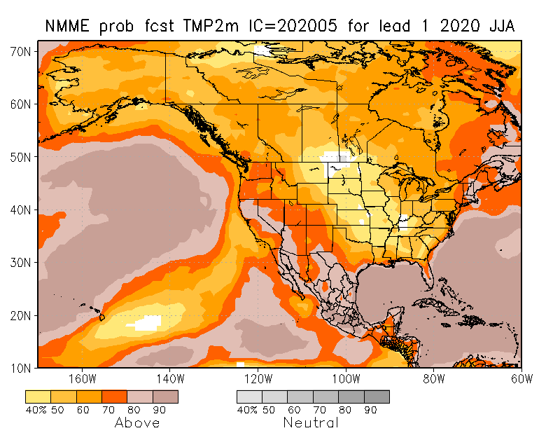
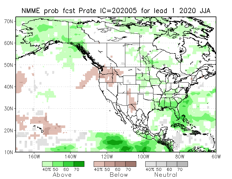
NOAA and its partners recently released the latest seasonal forecast from the North America Multi-Model Ensemble (NMME) project. As you can see below, they are expecting (with reasonably high probabilities) most of the country will see above-average temperatures this summer (Jun-Jul-Aug). The probabilities are particularly striking for parts of New Mexico and Texas. This signal for precipitation, however, is less clear. The NMME forecast is indicating there is a tilt in the odds for Far West Texas and the western half of New Mexico to be drier than average and for parts of East Texas to see above-average precipitation. For everything else in the middle, there is little to no confidence in what to expect. When NOAA releases its official seasonal outlook next week, they will most likely show the same no forecast for the middle part of the TSCRA region.