Livestock Wx for 1/29/21: Much colder temps on the way
Warm then Much Colder
We could be in store for some fairly cold conditions starting the first weekend in February. This will follow on a pretty warm pattern next week for much of the TSCRA region. The latest model runs are showing a large ridge over Alaska and a downstream trough over the western half
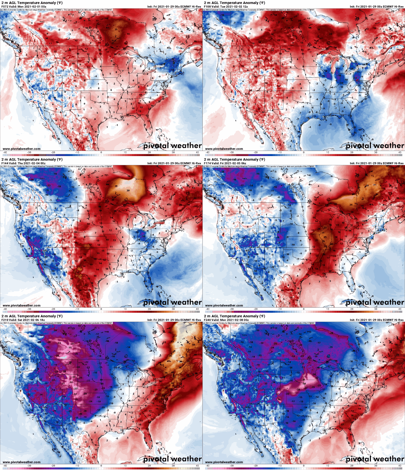
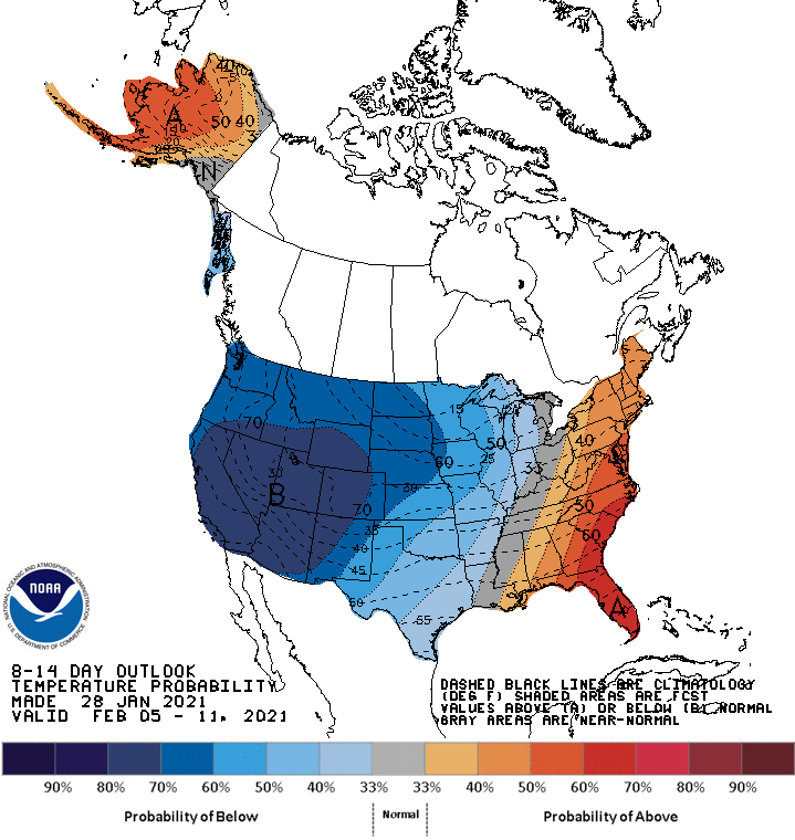
of the country that will bring very cold temperatures to the Northern Plains and the Southwest. In some areas temperatures could be 30-40 degrees below expected temperatures for early February. The trough is expected to move eastward bringing much below-normal temperatures to the Southern Plains around Saturday (February 6th).
Below we show the 8-14-Day Temperature Outlook from NOAA and the latest 10-Day temperature anomaly forecast from the European Model. Note the large departures from the temperature anomaly forecast loop.

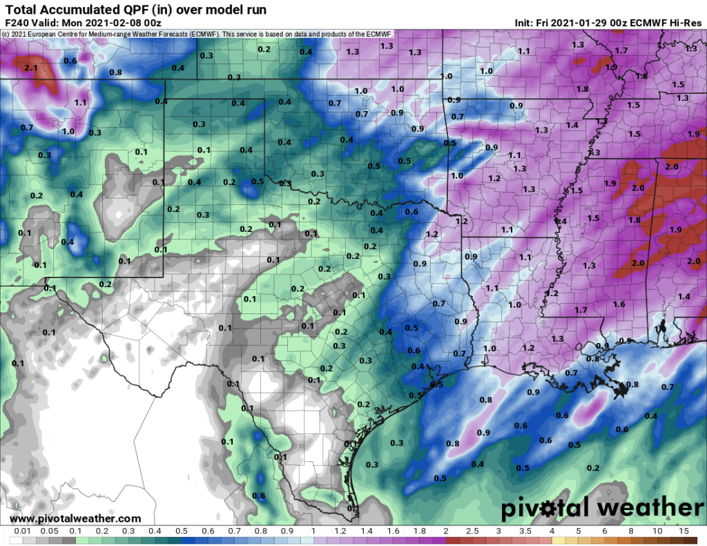
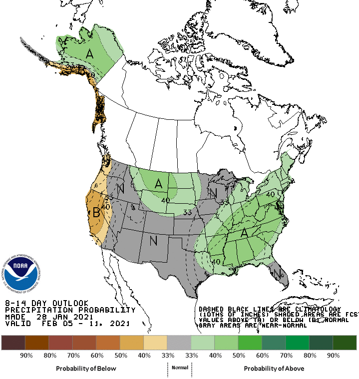
Downstream of the trough, much of the country could see near to above average precipitation over the same time frame. For the Southern Plains the one exception could be South Texas, which is not expected to see much precipitation over the next 10 days. Below is the 10-day accumulated precipitation forecast for the Southern Plains using the European Model. The forecast is consistent with the models runs from NOAA as well.

Hang on everyone, we’re not out of winter yet!


