Nov. 13, 2020
Seven-day temperatures and precipitation
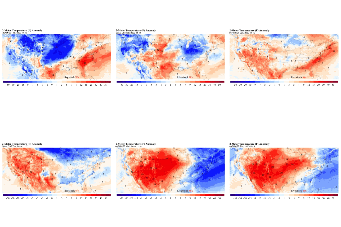
Seasonable turning to above average temperatures are expected over the next week (see temperature forecast map below) for much of the contiguous U.S. Later next week temperatures could be 10 degrees Fahrenheit or more above average.
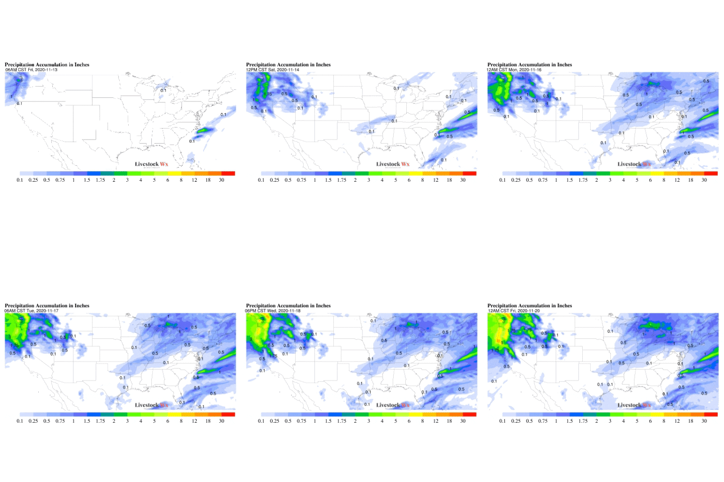
Over the next week precipitation is expected to be light for the TSCRA region (see accumulated precipitation map below). Areas like the TX/OK Panhandle and the South Plains, and New Mexico that have been very dry could see further deterioration of drought conditions.
8-14-Day Temperature and Precipitation
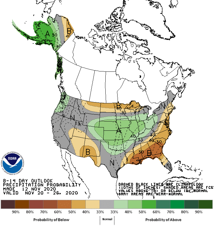
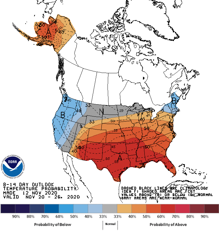
Beyond the 7-day forecasts, the 8-14-Day Outlooks are indicating we could see relatively unseasonably warm conditions for much of the TSCRA region. The outlook for precipitation is less clear, however. The outlook shows a minor possibility of above average precipitation for Oklahoma, and parts of the Panhandle and down into North Texas, but the probabilities are low. Far West and East Texas have a slight tilt in the odds of seeing dry conditions in the 8-14-day timeframe.
December Temperature and Precipitation Outlooks
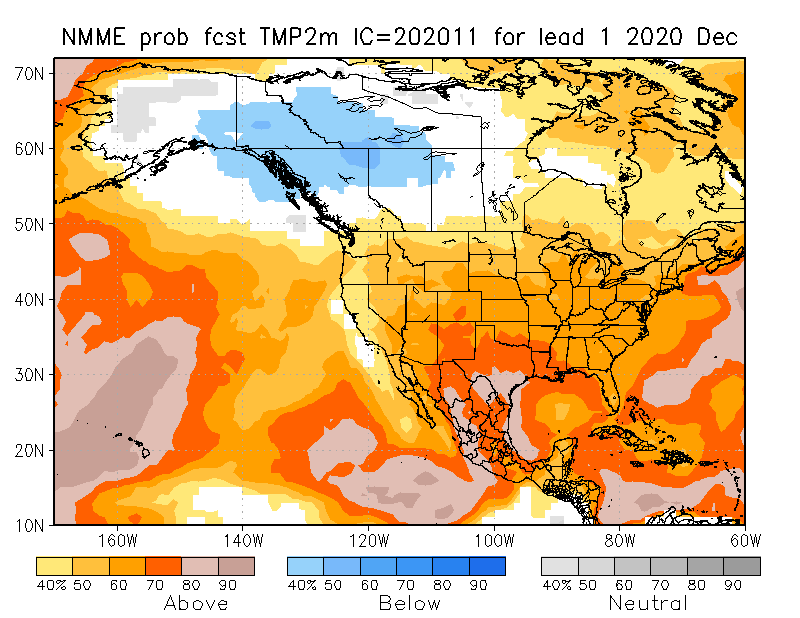
Looking ahead to December, we see the North American Multi-Model Ensemble (NMME) forecasts is indicating December has relatively strong odds of being warmer than average for the Southern Plains. The one exception is South Texas, which the models indicate could see average December temperatures.
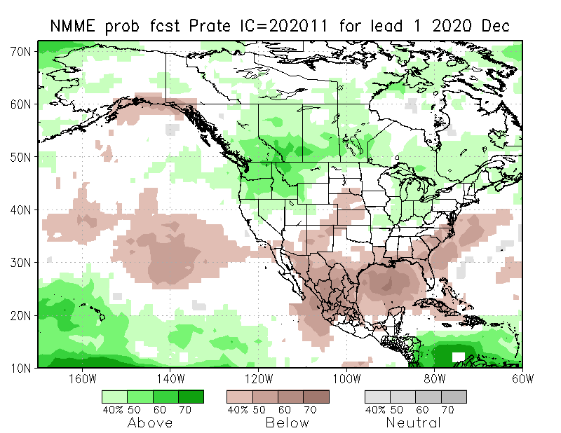
The NMME precipitation forecast for December unfortunately, is not very encouraging. While December is not usually a month where a lot of precipitation is expected, the areas that have been dry could continue to see deteriorating conditions, especially if temperatures will be above normal.
Looking at all three time periods (i.e. 1-Week, 8-14 Day, Monthly Forecast) it certainly looks like a typical La Niña pattern is setting up for the Southern Plains!

