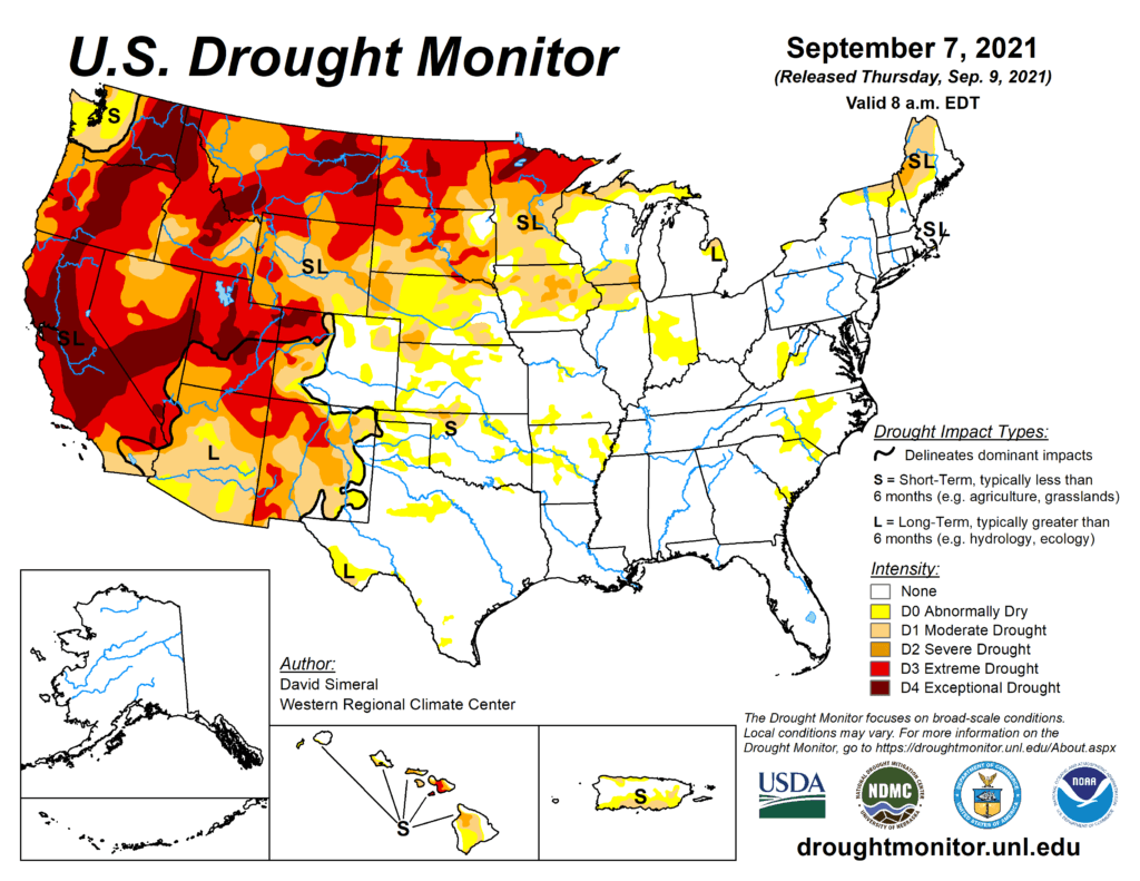
This Week’s Drought Summary
This U.S. Drought Monitor (USDM) week saw continued improvement in conditions across drought-stricken areas of the Central and Northern Plains states as well as in Iowa and Minnesota where light-to-moderate rainfall accumulations were observed. Despite recent precipitation in the Northern Plains, hay shortages and the associated costs of purchasing and transporting supplemental feed are forcing some ranchers to sell livestock. In response to the emerging situation, the U.S. Department of Agriculture (USDA) announced expansion of emergency assistance through the ELAP program to help cover feed transportation costs for drought-impacted ranchers. In the Northeast, the remnants of Hurricane Ida brought intense, heavy rains (5 to 10+ inches) and devastating flooding to areas of Pennsylvania, New Jersey, New York, and Connecticut. In the Southeast, short-term dryness (past 30- to 60-day period) and declining soil moisture and streamflow levels led to degradation on the map in portions of the Carolinas. In the South, short-term precipitation shortfalls and declining soil moisture levels led to some degradation of conditions in areas of Arkansas and Oklahoma that have largely missed out on recent rainfall events. Out West, dry conditions prevailed across most of the region this week. However, some beneficial rainfall was observed across isolated areas of the Southwest in association with the remnants of Hurricane Nora.
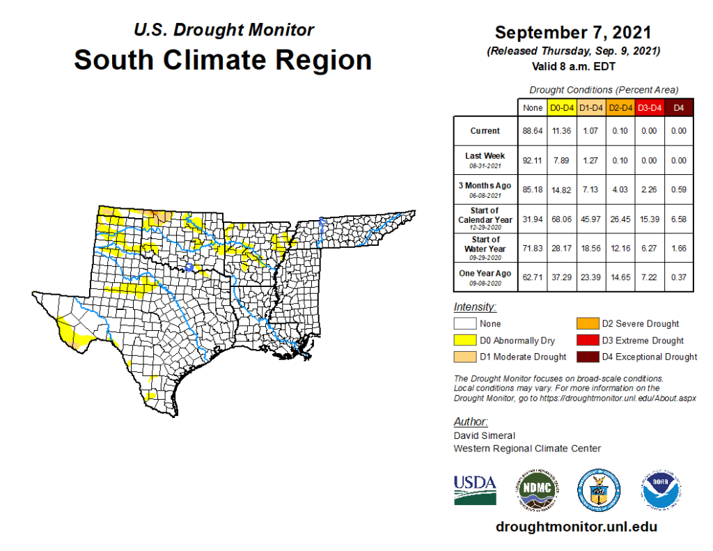
South
After the passing of Hurricane Ida, the region experienced some drying out this week as compared to the previous week’s deluge. For the past 30-day period, above-normal precipitation levels (130 to 300% of normal) have been observed across southeastern Louisiana, Mississippi, and much of Tennessee. Conversely, precipitation has been below normal across much of Arkansas, Texas, and Oklahoma during the past month, leading to expansion of areas of Abnormally Dry (D0). This includes around Tulsa, Oklahoma, which observed only 0.85 inches (normal 3.64 inches) for the month of August and no precipitation to date for September. Elsewhere, some minor improvements were made in an area of Moderate Drought (D1) in the Trans-Pecos region in the vicinity of Big Bend National Park where the Chisos Basin observing station reported 10.42 inches of rain (340% of normal) for the month of August. Likewise, the Pine Springs Guadalupe National Park observing station in the Trans-Pecos logged 8.98 inches (560% of normal) during August 2021. For the week, average temperatures were above normal (3 to 9 deg F) across Texas, Oklahoma, and western portions of Louisiana and Arkansas while areas to the east were 1 to 6 deg F below normal.