This Week’s Drought Summary
Several storm systems impacted various regions of the country this week as the transition to autumn continues. Temperatures through the Midwest and northern Plains remained unseasonal with departures of 9-12 degrees above normal. As cooler air came into the West, temperatures were 3-6 degrees below normal in the region and into the Southwest. The Pacific Northwest had several rain events that brought needed moisture into the region. Areas of eastern Arizona, New Mexico and Colorado also had above-normal precipitation for the week. A slow-moving cold front brought with it a line of showers from the Dakotas into Texas. This slow-moving rain maker brought relief to many dry areas of the Plains. Dry conditions dominated the northern Rocky Mountains as well as the coastal regions of the East from the Mid-Atlantic into Florida.

South
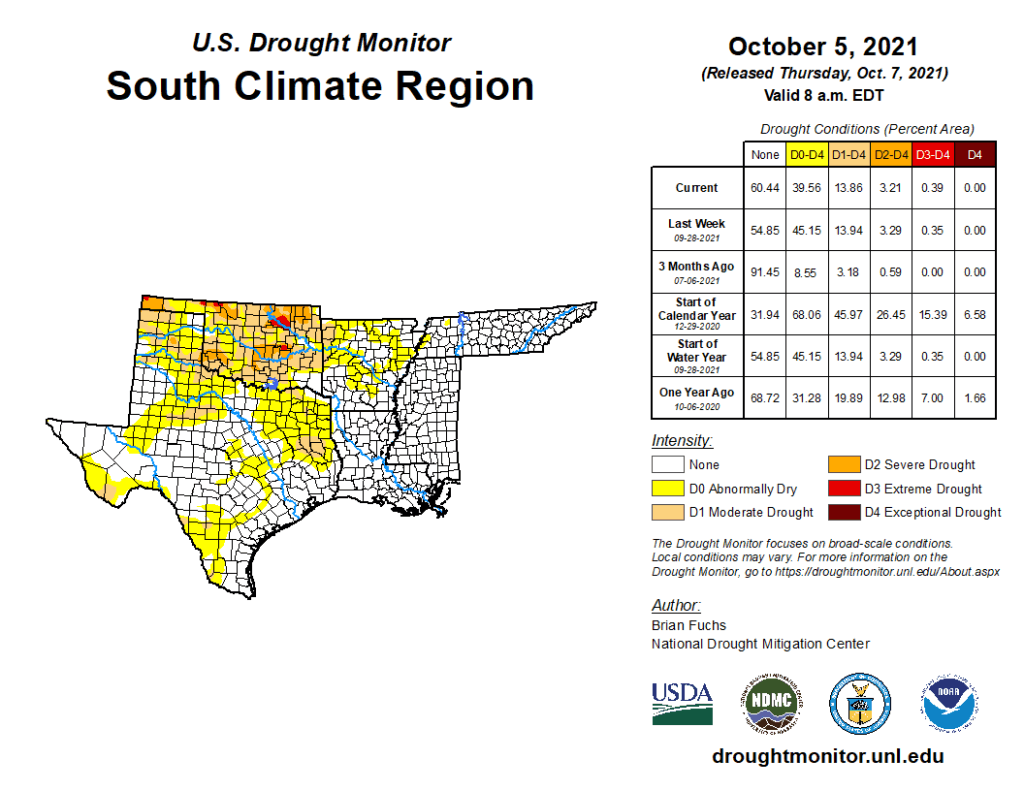
Temperatures across the region were generally warmer than normal with departures of 4-6 degrees above normal common. In contrast to last week, much of the region did see some beneficial rains that put the brakes on the recent dryness. Some areas did miss out, with the Oklahoma and Texas panhandles, east and west Texas and western Arkansas being the driest. Much of the abnormally dry areas introduced last week in Texas were improved this week with even some areas of moderate drought being removed in the south and central portions of Texas. Eastern Texas had an expansion of abnormally dry and moderate drought conditions, and in the Oklahoma panhandle, severe drought was expanded and a new area of extreme drought was introduced that also went into portions of southeast Colorado. Severe drought was expanded slightly in north central Oklahoma where rains missed while other areas of central Oklahoma had improvements to the drought status this week. Most of northern Arkansas had precipitation that helped to improve the abnormally dry conditions, but the spottiness of the rains also means that some areas continue to dry out.
