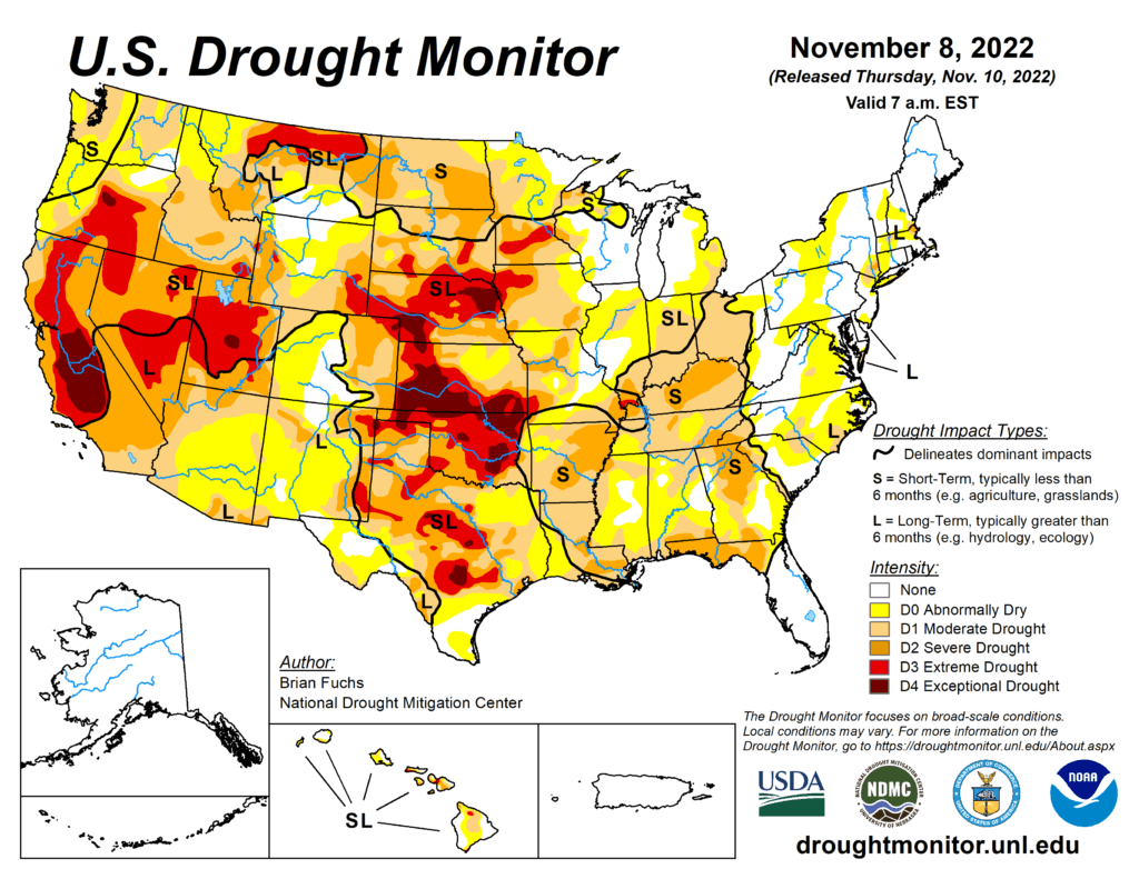
This Week’s Drought Summary
This week continued with another active weather pattern over portions of the Pacific Northwest as well as into the central Plains and Midwest. With widespread heavy rain from Kansas into Wisconsin as well as portions of the lower Mississippi River valley, some areas recorded significant precipitation during the period. Temperatures over the eastern half of the country were above normal, some significantly, while most of the West was cooler than normal. A continued wet pattern over the Pacific Northwest as well as portions of the Midwest has allowed for continued improvement to drought intensities, especially in areas that are receiving abundant precipitation. Dryness continues to build over eastern portions of the Midwest and into the Southeast as well as along the Gulf Coast.

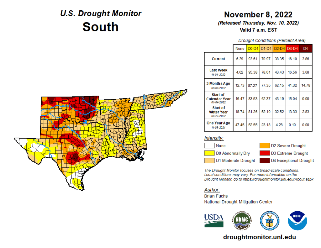
South
Temperatures over the region were well above normal, with departures of 6-9 degrees above normal during the week. Only areas of the panhandles of Texas and Oklahoma were near normal. The wettest areas of the region were in eastern Oklahoma, northeast and south Texas, Arkansas and Louisiana, where some areas recorded over 200% of normal rain this week. Much of central and west Texas and central Oklahoma missed out on any rains this week. A full category improvement to the drought intensities was made over much of Arkansas, western Louisiana, and eastern Texas. Severe drought was expanded over portions of southern Louisiana where much of the recent rain has missed. Drought intensities were expanded slightly in northeast Oklahoma and central portions of Texas due to a mixture of short- and long-term drought issues.
