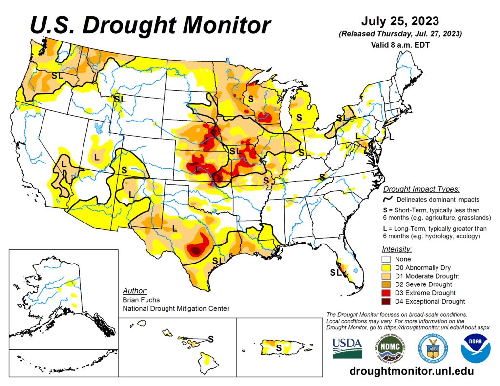
This week’s drought summary
Areas of the High Plains, Central Plains, Midwest and South had the most active precipitation patterns over the last week. Record-setting rains were recorded over western Kentucky and the area had significant flooding. The monsoon season in the Southwest has remained quiet with record-setting heat dominating the region into the southern Plains. Temperatures were cooler than normal over most of the central Plains, Midwest and Mid-Atlantic with departures of 2-4 degrees below normal widespread. Temperatures in the West, Southwest, South and Southeast were warner than normal, with some departures in Arizona 8-10 degrees above normal for the week and most other areas at least 2-4 degrees above normal.

South
Temperatures were cooler than normal throughout Oklahoma and most of Arkansas, but warmer than normal elsewhere with departures in west Texas 6-8 degrees above normal. Areas of northern Oklahoma and Arkansas recorded above-normal precipitation, but most other areas were dry with little to no rain this week. A new area of severe drought was added over east Texas into southern Louisiana. Moderate drought was expanded over east Texas and abnormally dry and moderate drought conditions expanded over south Texas with a new area of severe drought introduced. Severe and extreme drought expanded over central and eastern portions of Texas as well. Southern Mississippi had abnormally dry conditions expand this week related to short-term dryness.
