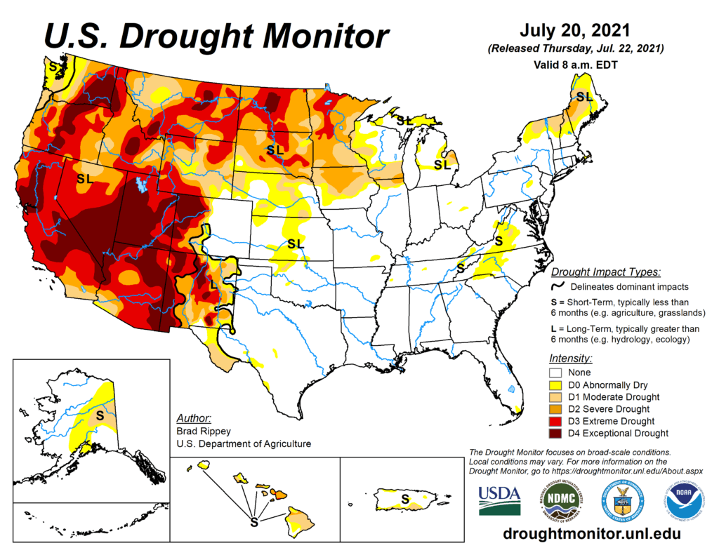
This Week’s Drought Summary
Active weather prevailed across much of the South, East, and Midwest, as well as parts of the Plains, into the middle of July, followed by a southward shift in widespread shower activity. Meanwhile, a robust monsoon circulation provided limited Southwestern drought relief, particularly in parts of Arizona, New Mexico, and southwestern Colorado. Farther north and west, however, little or no rain fell in California, the Great Basin, and the Northwest, where dozens of wildfires were in various stages of containment. Smoke and other particulate matter from those fires carried downwind at various atmospheric levels, producing hazy skies and reducing air quality—in some cases thousands of miles from the points of origin. Dry weather extended eastward across the nation’s northern tier as far east as Lake Superior, while heavy rain eased or eradicated drought in the remainder of the Great Lakes region, along with the Northeast. In the driest areas of the northern and western United States, drought’s impact on water supplies, as well as rangeland, pastures, and a variety of crops, was further amplified by ongoing heat. Weekly temperatures averaged as much as 10°F above normal from the interior Northwest to the northern High Plains. On July 19, temperatures as high as 110°F were reported in eastern Montana. Another pocket of hot weather was centered over the middle Atlantic States. In contrast, near- or slightly below-normal temperatures dominated the Plains, Midwest, and South.
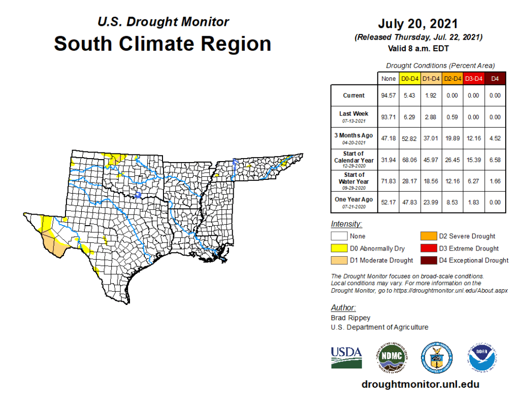
South
Patches of dryness (D0) and moderate drought (D1) have been relegated to a few areas in Oklahoma, Tennessee, and Texas. Broadly, there are few drought-related impacts in the South. Frequent summer rain events have maintained adequate to abundant soil moisture. On July 18, Mississippi led the region with topsoil moisture rated 33% surplus, according to the U.S. Department of Agriculture.