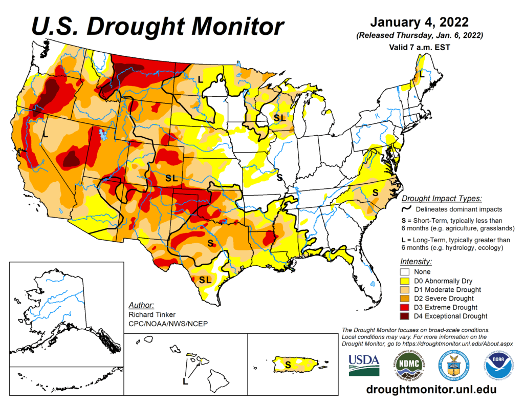
This Week’s Drought Summary
In what has become a familiar pattern, heavy precipitation continued to improve drought and dryness across the northern half of the West Coast States, though it created its own set of significant impacts. Farther south, similar totals fell on a relatively small area in southwest California. Heavy precipitation – some falling as heavy snow – also covered areas from the Ohio Valley and Middle Atlantic States southward through the Tennessee Valley, the interior Southeast, and the Carolinas. Parts of the Rockies – primarily the higher elevations – also reported moderate to heavy precipitation. Meanwhile, only light precipitation fell on the Northeast, across much of the lower Midwest, and along most of the Gulf Coast and adjacent areas. Most of the Plains and upper Mississippi Valley reported little or no precipitation. The result was some significant areas of drought improvement across the Carolinas and interior Southeast, as well as parts of the West Coast States and Rockies. In contrast, unseasonably warm and dry weather for several weeks prompted fairly broad areas of deterioration along the immediate central Gulf Coast, the southwestern half of the lower Mississippi Valley, and the southern Plains.

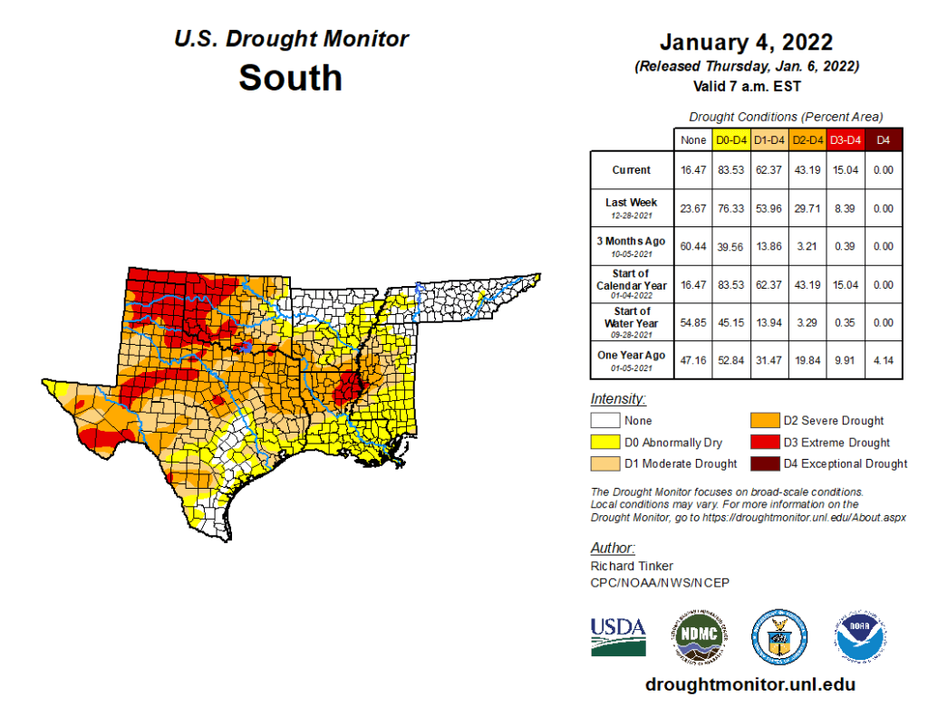
South
Eastern Tennessee – as with adjacent parts of the Southeast Region – reported at least 3 inches of rain, with as much as 6 inches in isolated spots. Farther west, less widespread 2 to 4-inch amounts extended across northern Arkansas and adjacent Oklahoma. As a result, improvement occurred in many existing areas of D0, keeping most of the northern tier of this Region drought-free and limiting D0 to some areas near the Mississippi-Ohio Rivers confluence, and interior eastern Tennessee. In stark contrast, several weeks of unseasonably warm weather and abnormal precipitation led to broad deteriorations across the southern half of the Region from Mississippi and Louisiana westward through significant portions of Texas. Over the last 2 months, precipitation totals were 4 to 8 inches below normal from eastern Texas through Louisiana into central Mississippi, leading to widespread D1 to and D2 across central Mississippi, northern Louisiana, and eastern Texas while D0 expanded southward to cover areas from central Louisiana and Mississippi all the way to the Gulf Coast. Farther west across central and western portions of Texas and Oklahoma, deterioration was not as widespread and there were some small scattered areas of improvement, However, most of central and western Texas, the Texas and Oklahoma Panhandles, and central Oklahoma recorded 25 percent of normal precipitation or less for the past 60 days..

