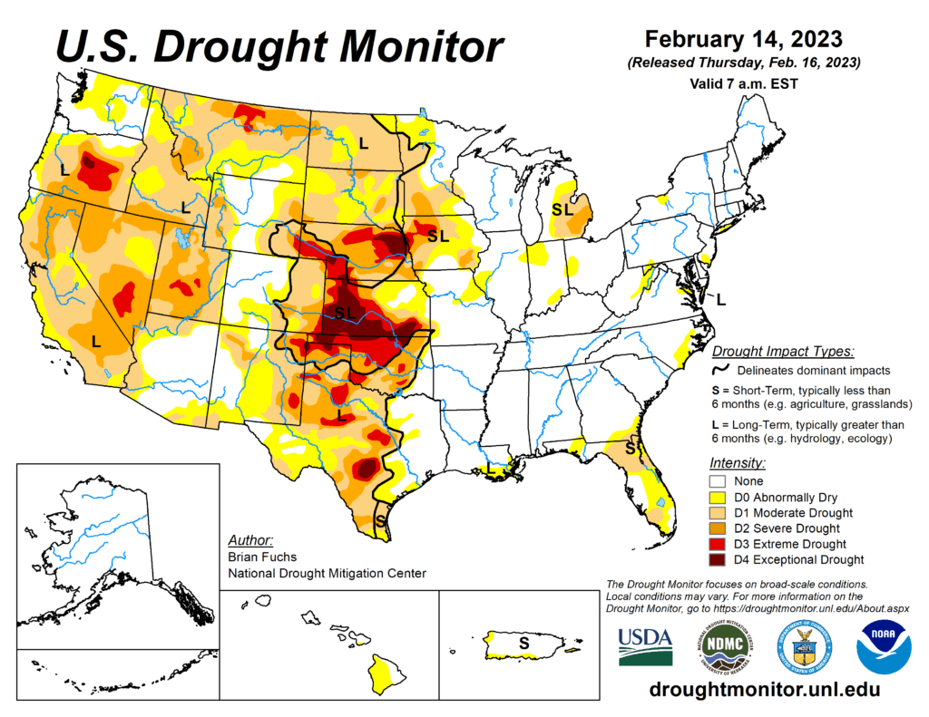
This week’s drought summary
An active weather week over much of the South, Southeast and portions of the Midwest allowed many locations in eastern Oklahoma, northern Arkansas, central Mississippi, northern Florida, southern Georgia and into coastal areas of South Carolina to record above-normal precipitation. Dry conditions dominated the West and northern Plains. Temperatures were well above normal in the northern Plains and upper Midwest, with departures of 15-20 degrees above normal. Most areas east of the Missouri River were above normal for the week with departures of 5-15 degrees above normal common. Cooler-than-normal temperatures dominated the intermountain West and into the Four Corners region where temperatures were 5-10 degrees below normal for the week.
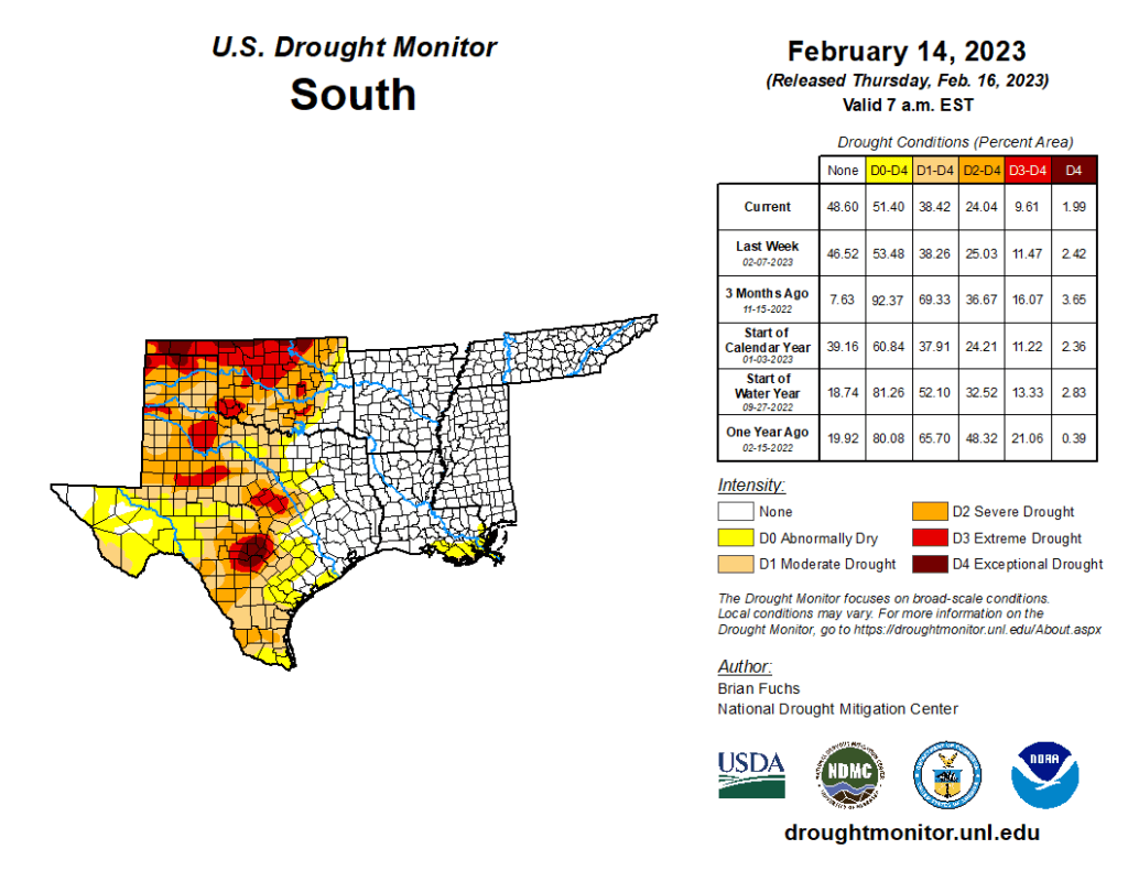
South
Precipitation was widespread throughout most of eastern Oklahoma, northern Texas, northern Arkansas and portions of southern Louisiana with most of these areas recording 150-200% of normal precipitation for the week. Temperatures were warmest in the eastern extent where Arkansas and Louisiana were 4-6 degrees above normal while most of Oklahoma and Texas were 2-4 degrees below normal. The recent wetter pattern allowed for most of eastern Oklahoma to observe a full category improvement to the drought intensities with abnormally dry conditions removed from the eastern extent and some exceptional drought improved as well. Areas of eastern Texas had improvements made to moderate drought and abnormally dry conditions but saw degradations, mainly on long-term indicators highlighting the changes over portions of the panhandle, central and south Texas.