Aug. 7, 2020
Temperatures and Precipitation over the next 10-14 days
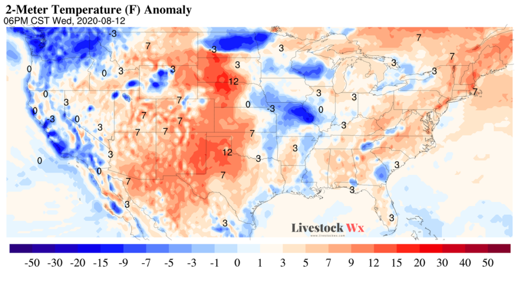
Over the next 10-14 days temperatures will mostly be near-normal (for August) across most of Texas and Oklahoma. We could see an exception this time next week (i.e. Aug. 12-14th map below) where temperatures could be 7-12 degrees F above normal in Far West Texas, the TX/OK Panhandle and up into the Central-Northern Plains.
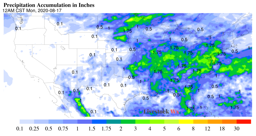
Rainfall over the next 10 days also looks relatively quiet for most of Texas and Oklahoma. The exception could be in eastern Oklahoma, which could see anywhere from a 1.5 to 3+ inches.
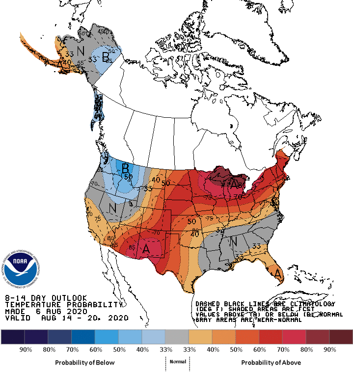
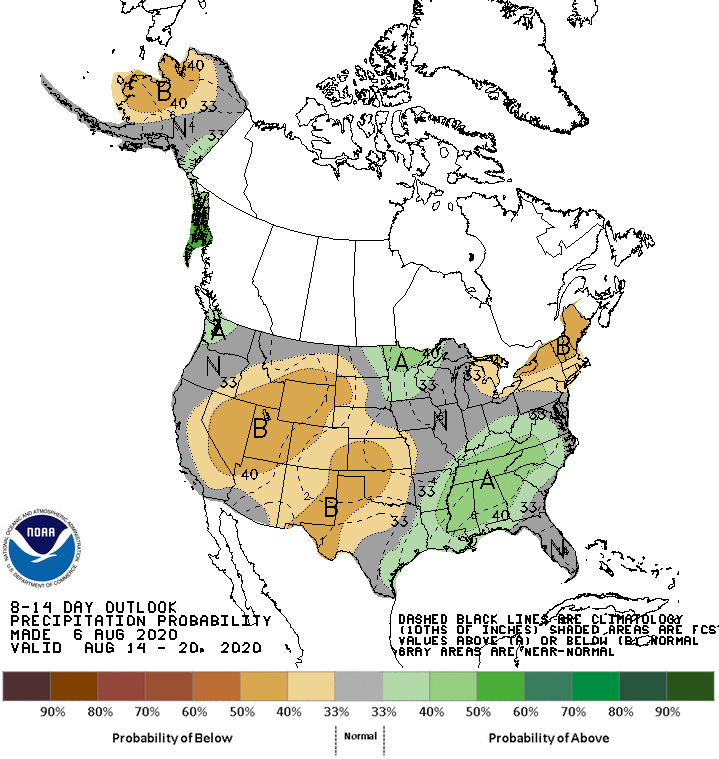
NOAA’s 8-14 Day Outlook for temperature and precipitation confirms the trends we’re seeing (see below).
Temperature and Precipitation Trends in July
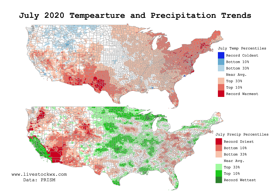
July temperature trends (top map below) shows a large area in Texas and New Mexico observed temperatures that were much above average for July. Areas in Far West Texas saw a record-breaking July.
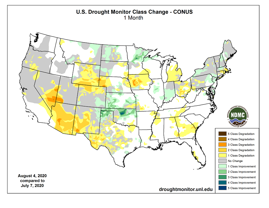
Precipitation trends were very uneven across the region. Oklahoma saw above normal rainfall, which helped dig them out of the drought that was firmly in place at the beginning of July. Of course, thanks to Tropical Storm Hanna, South Texas also received much above average rainfall for July. Again, Far West Texas did not do as well and like the hot July temperatures, rainfall in July was also disappointing. Most of the increase in drought area for Texas in the last month (based on the U.S. Drought Monitor) has occurred in this area.
August and September
Looking at the model output coming out of the North American Multi-Model Ensemble, August and September will likely be above average in terms of temperatures for the Contiguous U.S. As is usual for precipitation, though, it is less clear what could happen over the next couple of months. There is a small tilt in the odds August will be near normal for Central Texas, while South and East Texas could see above average rainfall in September. The model is not latching on to anything else for the remaining parts of the region, however.
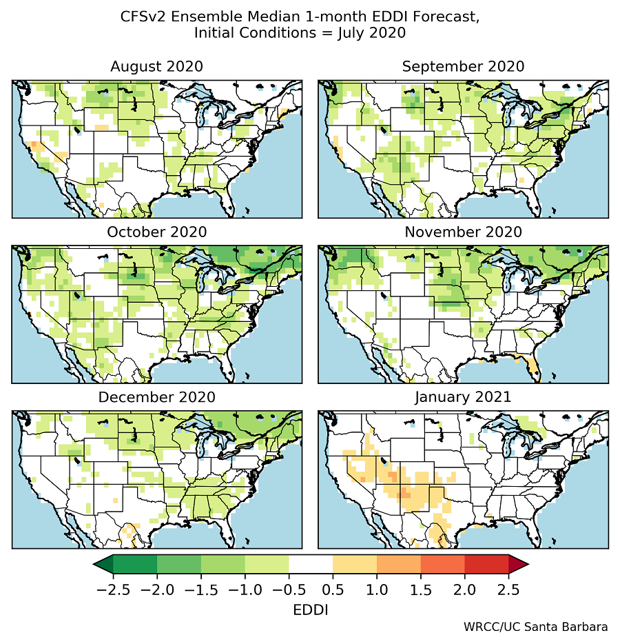
Another tool we’ve been using is the Evaporative Demand Drought Index Forecast (EDDI). The EDDI assesses the degree of drying the atmosphere places on soils and plants. As we’ve mentioned in previous posts it can have better forecast skill than just simply looking at a precipitation forecast. The EDDI forecast for August and September is showing near-normal drying for Texas, Oklahoma, and New Mexico. Most likely this could mean we are not going to see much drought improvement in those areas already in drought, but it could also mean we’re not going to see drought intensifying. For those struggling with dry conditions, this is not exactly comforting news but the forecasts have been wrong before and it will be interesting to see how well the EDDI forecast continues to do.
