
SPONSORED CONTENT Keep updated on the latest weather trends and outlooks with your personal daily weather planner—delivered each day via email. To subscribe to this free service, click here.
Livestock Wx for 1-4-19: Will the rain and snow continue?
Happy New Year everyone! It’s good to be back in the saddle here in 2019.
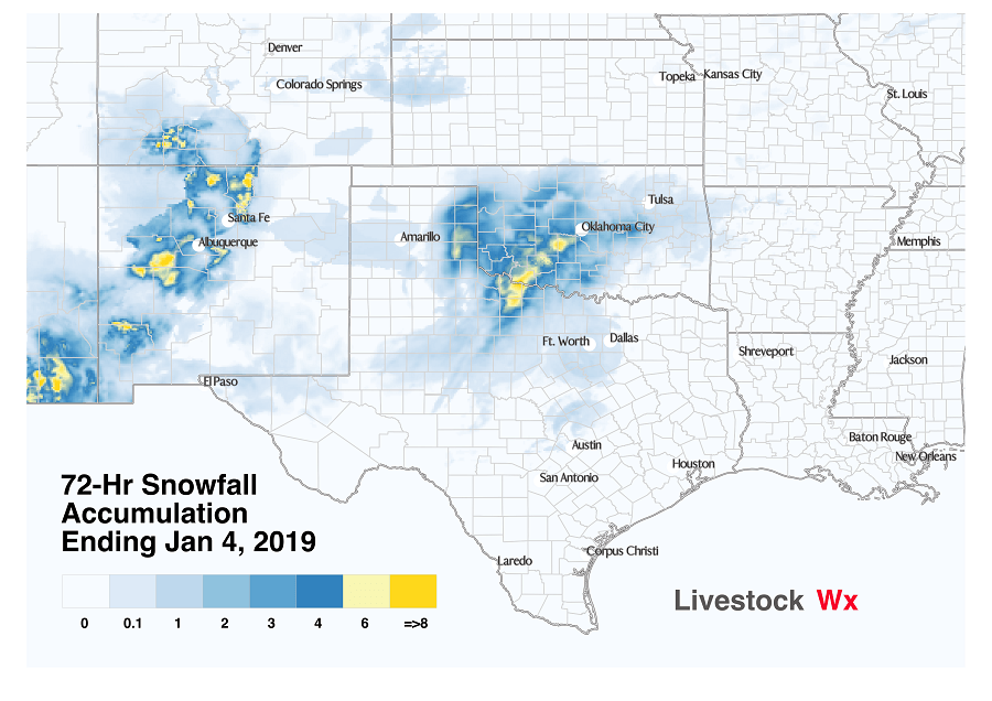
While we’ve been gone enjoying the holidays things have been busy. In particular, the last 72 hours have seen a good bit of snowfall across Texas and Oklahoma. The map below shows the 72 hours snowfall accumulation. As many have reported, Oklahoma City set a record with more than 4 inches of snow while Wichita Falls saw snowfall in excess of 2 inches.
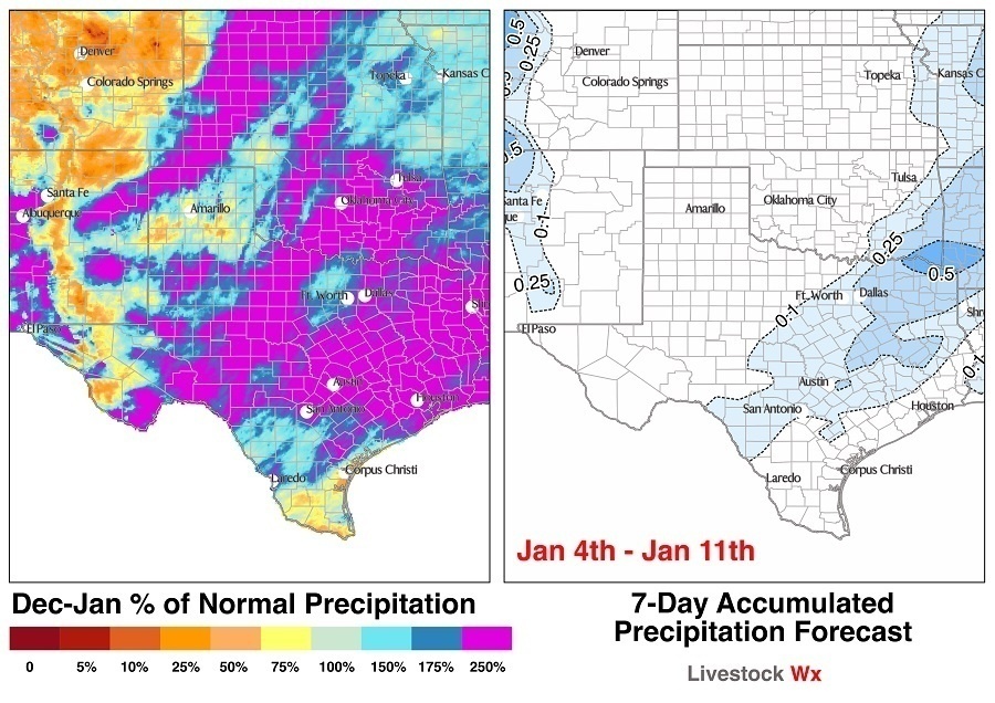
Snow notwithstanding, it has been a wet 30 days. The map below (left side) shows the percent of normal precipitation from Dec. 3, 2018, to Jan. 4, 2019. Most of Texas and Oklahoma have seen precipitation surpluses of 150 percent of normal or greater. There are, of course, exceptions. South Texas, Far West Texas and parts of the Texas Panhandle have not been as fortunate.
We have seen a little movement to the Abnormally Dry and Moderate Drought categories on the U.S. Drought Monitor for South Texas over the last month. Nothing to get excited about yet, but it is something to monitor. The right side of the map shows how much precipitation you can expect over the next 7 days. The way things have been going the 7-day forecast looks pretty tame!
Hang in there, winter can’t last forever. The NOAA 6 to 10- and 8 to 14-day outlooks are indicating we have enhanced odds of above normal temperatures over the next two weeks.