
Keep updated on the latest weather trends and outlooks with Livestock Wx’s Weekly Update email. To subscribe, click here.
Nov. 8, 2019: Odds for Warm Winter Good for Much of the U.S.
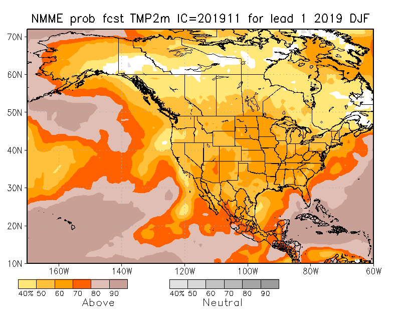
The latest outlooks from the North American Multi-Model Ensemble (NMME) were released this week. The NMME models consists of an ensemble, or average, of numerous federal and university climate models. Despite a very cold late fall across much of the nation, the NMME consensus forecast for winter temperatures is showing relatively high odds of above-normal readings for much of the Contiguous U.S. (see map below)
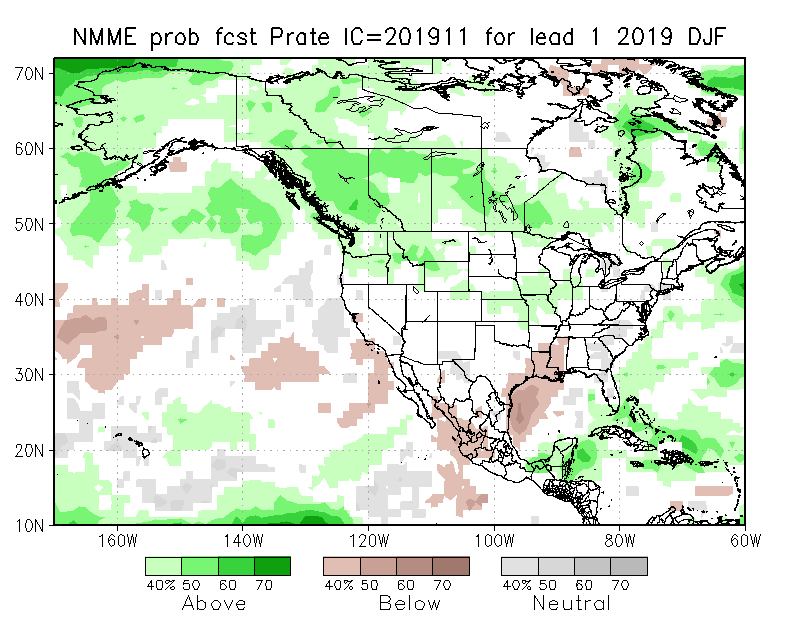
The outlook for winter precipitation is a little less clear. The NMME consensus forecast below shows enhanced odds of below-normal precipitation for parts of the Gulf Coast, portions of East Texas and Louisiana and Mississippi. Taking a closer look at the individual NMME models shows the models do not all agree. Three out of the seven models show a large portion of Texas and Oklahoma dry, while two other models show a wet forecast, and two more show precipitation is expected to be near normal!
As mentioned above, though, the real power of the NMME is that you can look at the individual models and weigh the ones that have the best skill. In this case, the ones with the best skill are the models showing below-normal precipitation across much of the Gulf states. The rest of the region (the area in white) unfortunately shows no indication whether it will be a wet/dry or near-normal winter. The models just can’t agree….
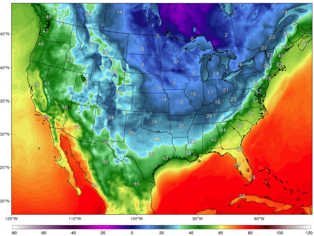
Monday and Tuesday Temperature Departures
Get ready, cold temperatures are expected to hit Texas and Oklahoma Monday afternoon and should persist over the next three days. Below freezing conditions are expected from the Panhandle, the Rolling Plains and North Texas. South Texas start digging for your coats because this system will make it down to you. You should see temps in the 40’s, which is 25-30 degrees below average! The below map shows the temperature forecast for Tuesday morning.
Texas & Southwestern Cattle Raisers Association
To Honor and Protect the Ranching Way of Life
PO BOX 101988
FORT WORTH, TX 76185
1-800-242-7820
© 2023 Texas & Southwestern Cattle Raisers Association; All Rights Reserved.