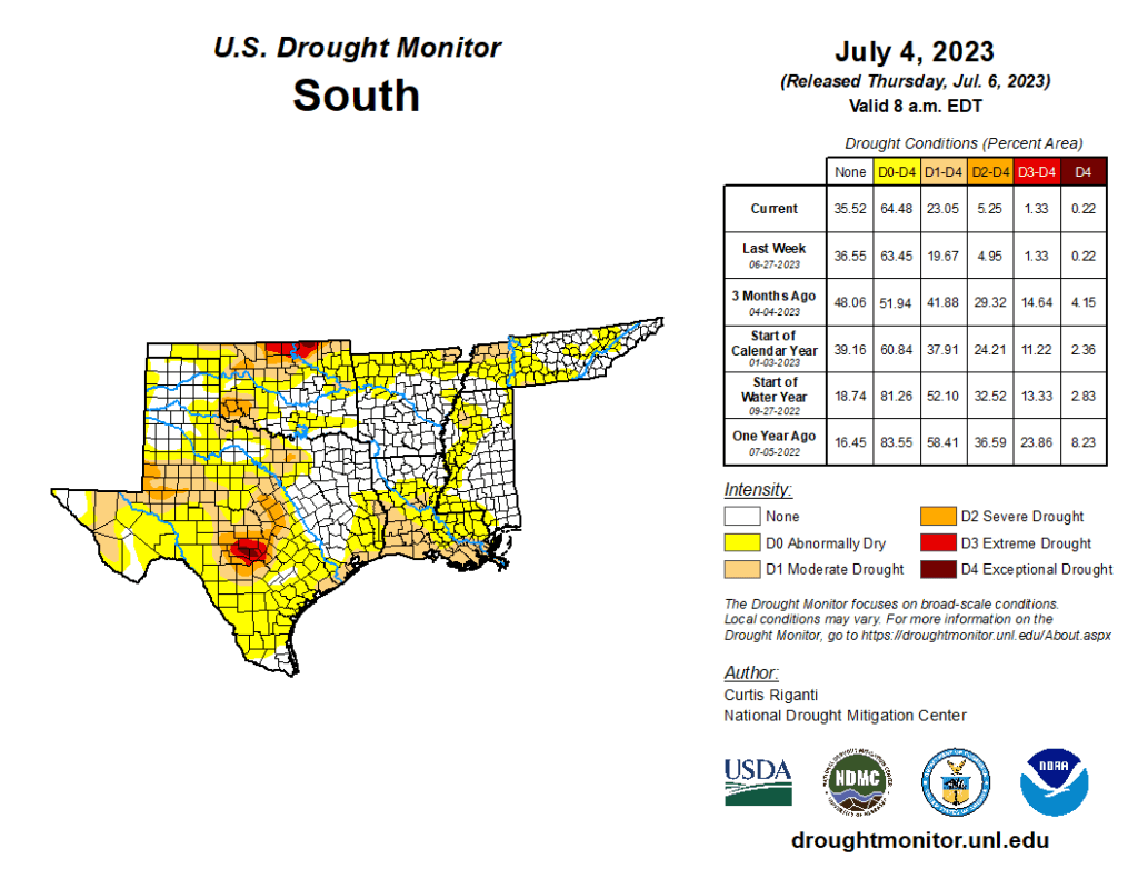
This week’s drought summary
Heavy rains fell this week across parts of the Midwest, Ohio River Valley and Northeast, which led to widespread improvements from southeast Nebraska to central Illinois, southern Indiana, and central and eastern Kentucky. To the south and west, in southern Missouri, the Texas-Louisiana border and other parts of central Texas, drier weather led to worsening precipitation deficits, and significant problems with hay production in parts of southern Missouri. Dry weather in the Upper Midwest led to further degrading conditions in parts of Michigan, Wisconsin and Minnesota. A re-evaluation of conditions in parts of the western Great Plains led to some improvements to long-term dryness and long-term moderate drought in the Texas and Oklahoma Panhandle region, and in western Nebraska and eastern Wyoming, respectively. A mix of degradations and improvements occurred in the Pacific Northwest. No changes were made to the USDM depictions this week outside of the Lower 48.

South
Much warmer-than-normal temperatures covered the South as it is enveloped in the continuing heat wave, especially eastern Texas and Louisiana where temperatures ranged from 4 to 8 degrees above normal compared to the rest of the region where temperatures were near normal to 4 degrees above normal. There was expansion of abnormal dryness and moderate drought along the western Gulf Coast where temperatures soared and little to no precipitation fell, providing no relief to the low streamflows and dry soil conditions. Tennessee did see the removal of moderate drought conditions along the Tennessee-Kentucky border after heavy rainfall. Conditions were status quo for the rest of the region despite seeing warmer-than-normal temperatures and slightly below-normal precipitation this last week.
