Keep updated on the latest weather trends and outlooks with your personal daily weather planner—delivered each day via email. To subscribe to this free service, click here.
Livestock Wx for 2-28-19: Drought starting to take hold?
It has been a harsh winter across a good part of the Midwest, Northern Plains, and Great Lakes regions. As the saying goes, there’s no rest for the weary and this March will continue the weariness with yet another blast of unusually cold air.
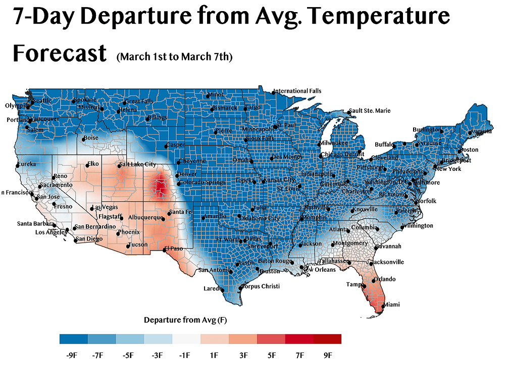
Cold arctic air will overspread the nation starting this weekend and persist through the first week of March. This spell will make it deep into Texas (forecast map below), making those South Texans dig deep for their winter coats.
A number of record low temperatures could be observed early next week, including record lowest high-daily temperatures. The cold spell should be finished by next weekend and then it will be back to norm or above-normal temperatures in some cases.

Drought Creeping In?
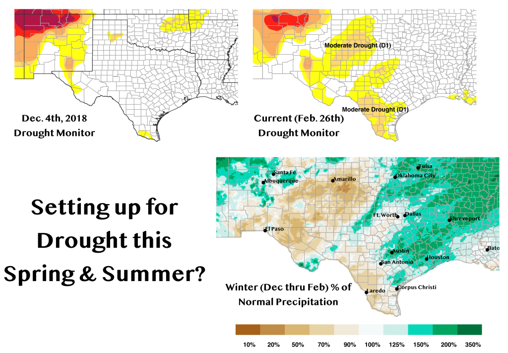
The other thing we’re watching is dryness starting to take hold in the Texas Panhandle, Far West and South Texas. Moderate Drought, as defined by the U.S. Drought Monitor, has made its way into these areas over the last month. The map below shows the Drought Monitor in early December to present and the percent of normal precipitation since December. The area around Amarillo, in particular, has observed precipitation deficits 20 percent or less than normal. This is not typically a wet time of year for these areas so take this with a grain of salt, but it is something we will continue to monitor as we get into spring.

