SPONSORED CONTENT
Livestock Wx for Jan. 24, 2020: Drought Picture Not Expected to Change Much over the Next 10 Days
Drought Status
Over the last seven days, parts of Texas and Oklahoma received 2 or more inches of precipitation. For the areas that have been in drought like the Hill Country, the precipitation helped with short-term deficits, but longer-term deficits still remain. The have-nots over the last week included parts of West and South Texas and up into Western Oklahoma, which received less than half an inch.
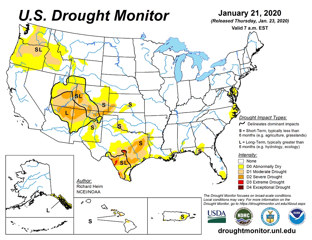
For areas that have been dry and did not receive much moisture over the last week, the long-term deficits going back 6 months or more continue to decline. The below maps show the latest U.S. Drought Monitor Map published Thursday, Jan. 23 and the 1-Month Drought Monitor Change Map. The Change Map show areas that have either improved (green), declined (yellow), or stayed the same (grey) over the last month.
Currently, 34% of Texas is in drought, which slightly improved from last week. Oklahoma sits at 9% of the state in drought, while 32% of New Mexico is considered in drought. New Mexico saw the largest expansion of drought of the three states over the last week with an increase of 4 percentage points.

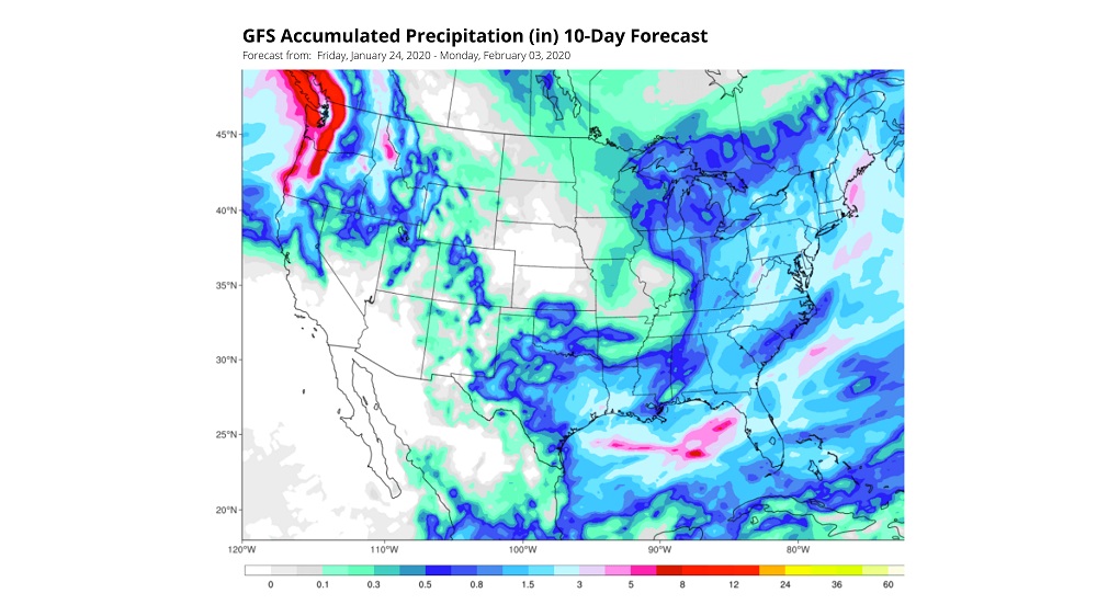
10-Day Temperature and Precipitation Forecasts
Looking at both the NOAA and European forecast models, temperatures are expected to be above average into early February. The exception being the end of January, which could see some slightly cooler than average temps. For precipitation, a half-inch to an inch of precipitation will be widespread from North and Central Texas, the Texas Panhandle, and Western Oklahoma. The map below shows the 10-day accumulated precipitation from NOAA’s GFS model. For those needing moisture, though, the next 10-days will likely not change the picture much as the precipitation expected to fall will not make much of a dent in those long-term moisture deficits.