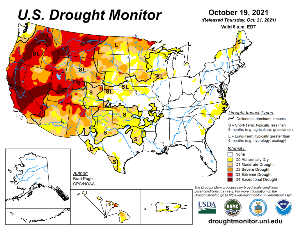
This Week’s Drought Summary
A strong low pressure system resulted in widespread precipitation (0.5 to 3 inches, liquid equivalent) from the central Rockies east to the northern and central Great Plains from October 11 to 13. More than a foot of snow blanketed parts of Montana, Wyoming, and western South Dakota. Along a trailing cold front, heavy to excessive rainfall (1 to 3 inches, locally more) occurred across eastern Oklahoma and central to eastern Texas. As this front progressed eastward, scattered thunderstorms with locally more than one inch of rainfall swept across the Ohio and Tennessee Valleys. Much of New York and northern New England received 1 to 2.5 inches of rainfall on October 16. Only light weekly precipitation amounts (generally less than 1 inch, liquid equivalent) were observed along the Cascades, coastal ranges of the Pacific Northwest, and northern Sierra Nevada Mountains from October 12 to 18. Dry weather prevailed throughout much of the Southeast, Southwest, and northern Intermountain West during this 7-day time period. Southeastern Mainland Alaska and the Alaska Panhandle received near normal precipitation amounts during mid-October. Enhanced trade winds resulted in locally heavy rain across east-facing slopes of the Big Island of Hawaii recently. Locally heavy rainfall also occurred throughout Puerto Rico this past week. 7-day temperatures (Oct 12-18) remained above average across the eastern third of the U.S., while below average temperatures were observed over the West.
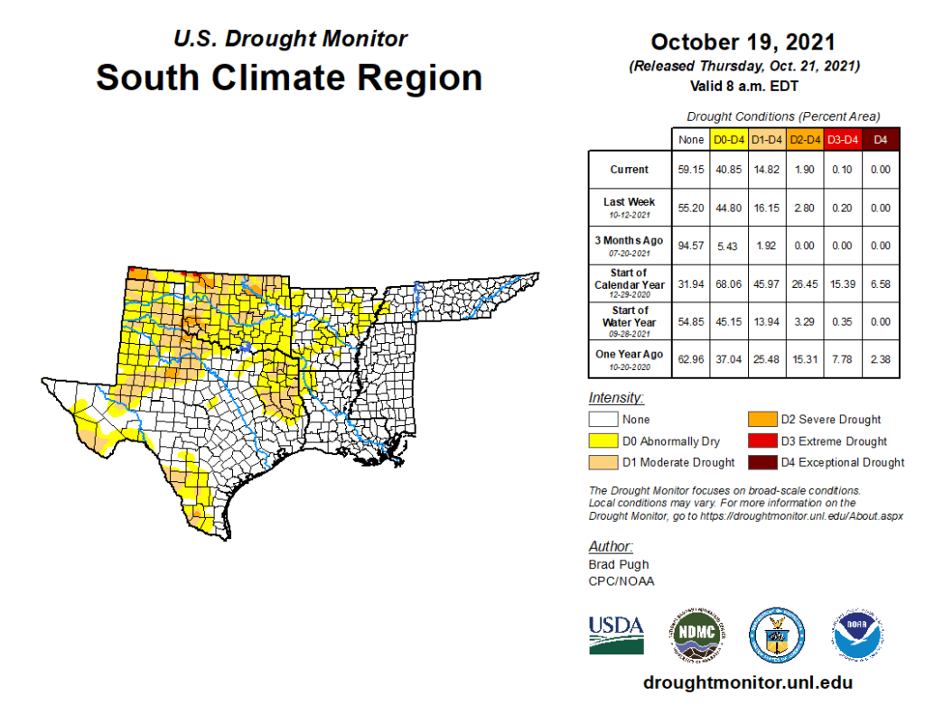
South
Following rapid expansion of D0 (abnormal dryness) and D1 (short-term moderate drought) during September across Oklahoma and northwest Arkansas, above normal precipitation during the first half of October resulted in a continued decrease in the coverage of D0 and D1. Month-to-date rainfall amounts totaled 2 to 6 inches throughout much of central and eastern Oklahoma along with northwest Arkansas. Farther south into central Texas, recent heavy rainfall also supported minor modification to the ongoing D0 and D1 areas. Abnormal dryness (D0) was maintained for parts of southeast Oklahoma due to ongoing 30 to 60-day indicators and lower rainfall amounts during the past two weeks. Abnormal dryness (D0) and short-term moderate drought (D1) was expanded slightly to include more of southwest Arkansas and northwest Louisiana which missed out on the heavier rainfall this past week and precipitation deficits have increased. Moderate (D1) to severe (D2) drought continues to expand across west Texas where 60-day precipitation deficits range from 2 to 5 inches and soil moisture indicators have worsened.