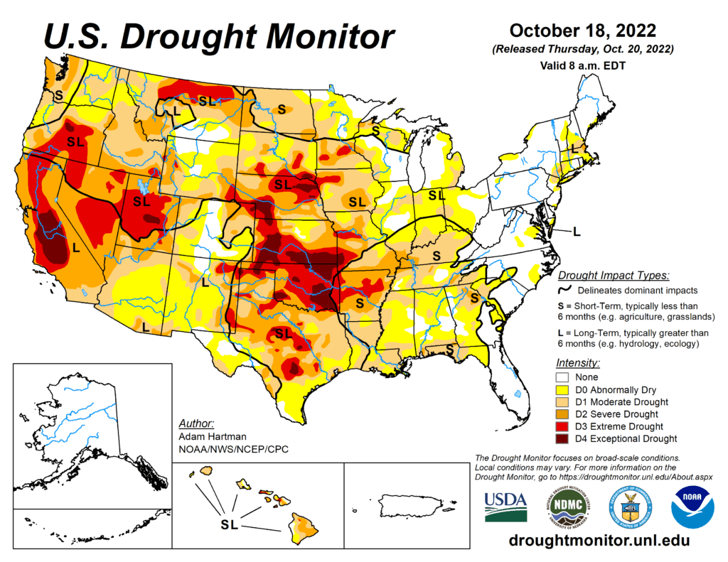
This Week’s Drought Summary
Much of the western half of the lower 48 states observed above-normal average temperatures this week. The Intermountain West and Pacific Northwest experienced the largest positive temperature anomalies, where widespread temperatures averaged 5°F to 10°F above-normal, with a few pockets exceeding 10°F above-normal for the week as whole. In addition to the above-normal temperatures, precipitation was also lacking for most areas from the Central and Northern Plains westward to the Pacific Coast, warranting drought deterioration. Parts of the Four Corners and Desert Southwest were the exception to this, as an area of low pressure meandered across the Southwest before being picked up by a frontal boundary dropping southward across the central U.S. This resulted in improvements to long-term drought conditions across parts of the Four Corners, with targeted improvements in the Southern Plains. Across the eastern half of the lower 48, frontal boundaries associated with a couple of strong low pressure systems in the Great Lakes brought heavy precipitation and cooler than normal temperatures to portions of the Great Lakes, Northeast, and Southeast. Therefore, a widespread mix of improvements and deterioration was warranted in many locations where the heaviest precipitation did and did not fall, respectively.

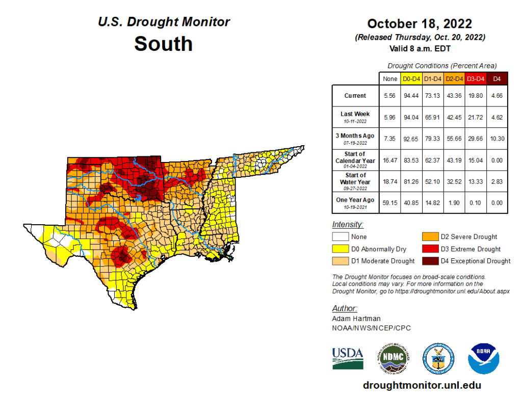
South
Frontal boundaries associated with a couple of strong low pressure systems over the Great Lakes brought heavy precipitation to parts of the Red River Valley of the South, the Ozarks, and the Tennessee Valley this week. Farther westward toward the Rio Grande Valley, a cutoff low pressure system became entrained into the second frontal boundary dropping southward across the central U.S. bringing heavy rainfall to parts of western and southern Texas. Improvements were generally warranted in areas receiving the heaviest rainfall (greater than 1 inch positive 7-day anomalies). However, antecedent 30-day dryness resulted in status quo depictions for several other locations receiving near to above-normal rainfall, as surface soil moisture has rapidly declined due to widespread 3 to 5 inch 30-day precipitation deficits and predominantly above-normal temperatures. This dryness also extends to 60 to 90 days for several areas across the Southern Plains and along the Gulf Coast, warranting 1-category deteriorations in the drought depiction for many locations not receiving rainfall this week.
