This Week’s Drought Summary
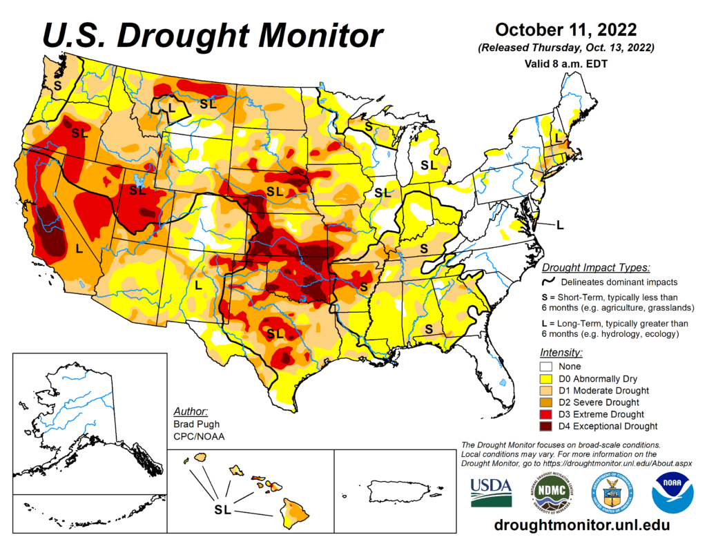
Following a drier-than-normal September for a majority of the contiguous U.S., this dry pattern continued into early October for many areas. Therefore, drought coverage increased and intensified throughout the Pacific Northwest, Great Plains, Ohio River Valley, and Southeast. From October 4-10, heavy rainfall (1 to 3 inches) was limited to the northern Mid-Atlantic, southern New England, and parts of the Southwest. New Mexico was especially wet this past week and this much above-normal precipitation extended eastward into west Texas. 7-day temperatures, ending on October 10, averaged above-normal across the West. Cooler-than-normal temperatures were observed from the Mississippi Valley to the East Coast with the first freeze of the season affecting parts of the Midwest.
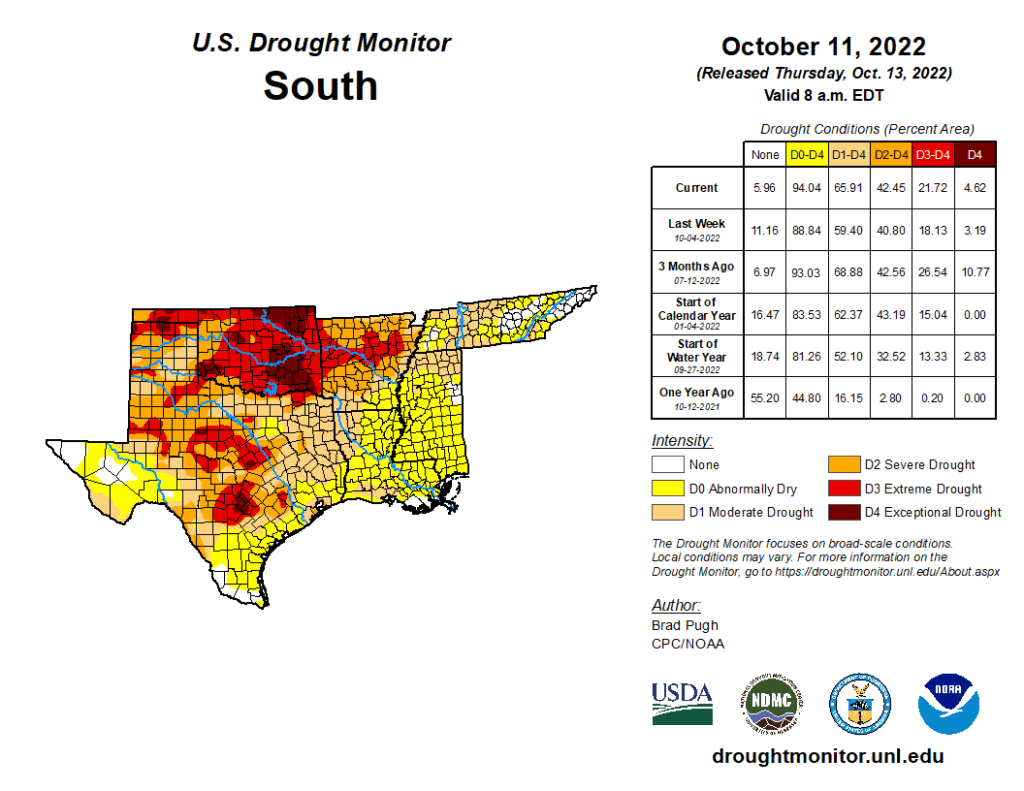
South
Widespread, heavy precipitation (1 to 3 inches) during early October along with a wet 2022 Monsoon supported large-scale improvements across New Mexico. These improving drought conditions extended eastward to include western Texas. During the past week, rainfall amounts ranged from 2 to 4 inches, locally more, across the Davis Mountains, Trans Pecos, and southern Permian Basin of western Texas. Farther to the east across central and eastern Texas, another week of degradations were made. Based on 120-day, soil moisture, and impact reports, the coverage of D3 (extreme) to D4 (exceptional) drought was expanded across parts of Oklahoma. Rainfall was not enough to justify any improvements in southwestern Oklahoma with little to no response in soil moisture. Increasing 30-day deficits resulted in a 1-category degradation across parts of Arkansas, Louisiana, Mississippi, and Tennessee. The expanding D3 area in Arkansas was based on 30 to 60-day SPI and soil moisture indicators.