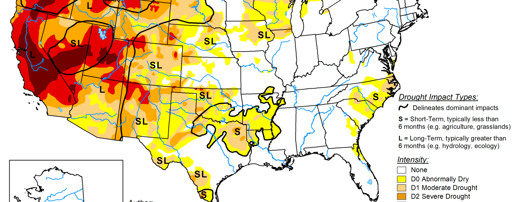
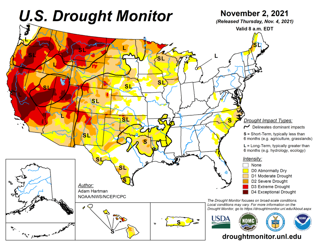
This Week’s Drought Summary
This week, a low pressure system slowly moved eastward across the eastern contiguous U.S. (CONUS) bringing heavy rainfall to many areas from the Mississippi Valley to the East Coast. Parts of the Central Plains, Gulf Coast, Northeast, and Mid-Atlantic saw over 2 inches of rainfall. Improvements were warranted where the heaviest precipitation fell across parts of the Central and Northern Plains, the Corn Belt, and northern New York and New England. Conversely, areas that missed out on adequate precipitation across the western Great Lakes and the Carolinas experienced degradation of ongoing abnormally dry and drought conditions, exacerbated by above-normal temperatures and increased evaporative demand. Across the western CONUS, an active storm track in the Pacific Northwest resulted in another week of improvements from Washington to northwest Montana. Soil moisture indicators continue to improve across much of the Western Region, leading to some localized improvements, but for most areas, long-term deficits remain intact and groundwater and reservoir levels remain well below-normal. Additionally, it is too early in the season for solid snowpack to build across many areas. Some localized degradations were warranted in Montana, east of the Front Range, and in the Southern Plains, as above-normal temperatures and high wind events have helped to worsen ongoing drought in those areas.
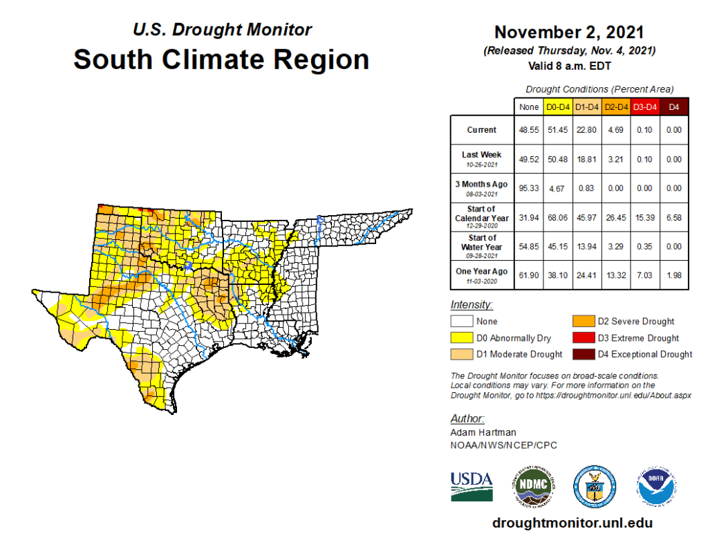
South
Rainfall amounts, associated with a slow-moving low pressure system traversing the eastern half of the Southern Region (eastward from Arkansas and Louisiana) were just enough to warrant a status quo depiction this week. Conversely, rainfall from this same low pressure system early in the week was heavy enough to warrant improvements across much of eastern Oklahoma, where many locations received more than 150 percent of normal precipitation for the 7-day period. Farther south, in eastern Texas, 7-day precipitation was below-normal, despite 0.5-1 inch of rainfall across a large region experiencing moderate (D1) to severe (D2) drought. Above-normal temperatures and high winds associated with the exiting low pressure system resulted in increased evaporative demand across much of eastern Texas. Despite the rainfall, there was even a report of a wildfire near Rusk County, Texas. Farther west across the Southern High Plains, conditions also deteriorated, resulting from D1 to D3-equivalent 30-90 day Standardized Precipitation Indices (SPIs), widespread NASA SPoRT soil moisture rankings below the 10th percentile (below the 5th percentile at shallower depths for many locations), below-normal precipitation, and above-normal temperatures (2-6°F above-normal).