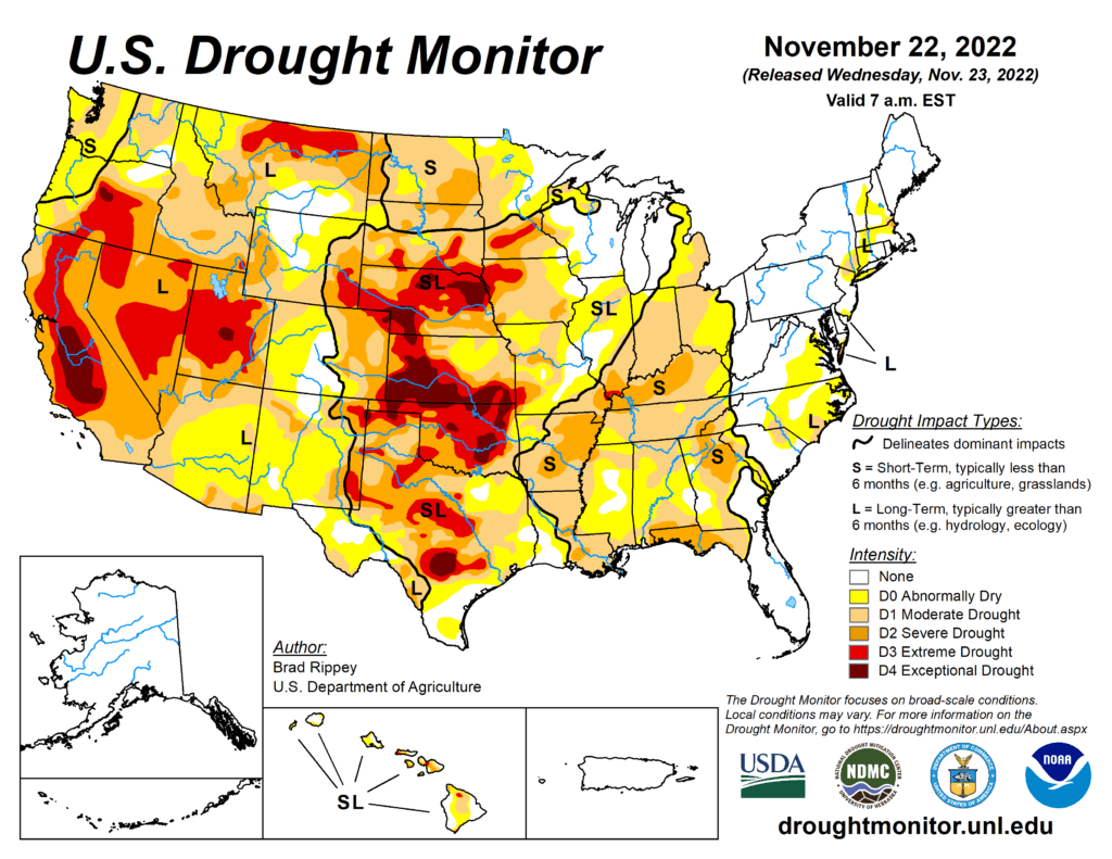
This Week’s Drought Summary
Cold, dry weather prevailed nearly nationwide, with a few exceptions. Notably, mid-November snow squalls developed downwind of the Great Lakes, resulting in localized totals of 2 to 6 feet or more. In addition, precipitation fell in parts of the South, East, and Midwest, primarily early in the drought-monitoring period, although most liquid-equivalent totals were under 2 inches. Snow broadly blanketed the Midwest and interior Northeast, especially on November 15-16, although amounts were mostly light to moderately heavy. Meanwhile, deep snow from a previous storm remained on the ground in much of Montana and North Dakota. As the period progressed, rain lingered in the western Gulf Coast region. Elsewhere, negligible precipitation fell across the western half of the country. On the Plains, the combination of cold weather and soil moisture shortages maintained significant stress on rangeland, pastures, and winter wheat. Weekly temperatures averaged at least 10°F below normal nationwide, except in the Desert Southwest and along the Atlantic and Pacific Coasts.
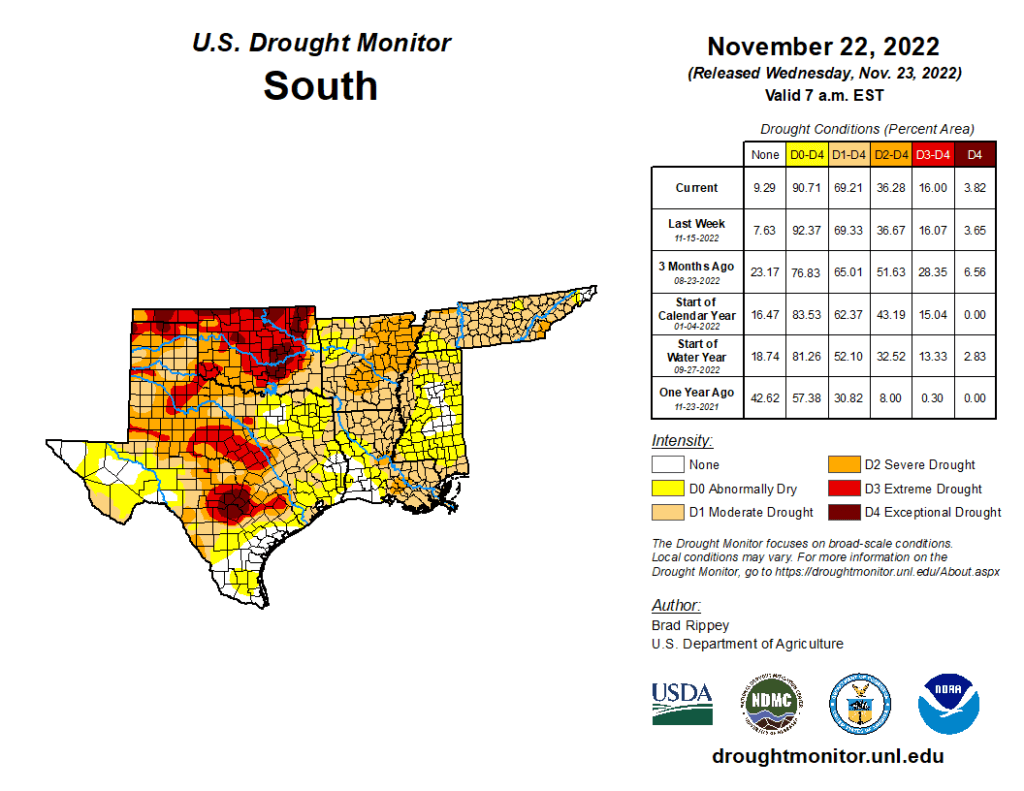
South
Significant rain fell in parts of the western Gulf Coast region, but most of the remainder of the South experienced cold, dry weather. According to the U.S. Department of Agriculture, Oklahoma and Texas were tied for the regional lead on November 20 with topsoil moisture rated 67% very short to short. On the same date, very poor to poor rating were observed in Texas for 58% of the rangeland and pastures; 52% of the oats; and 49% of the winter wheat. Similarly in Oklahoma, 41% of the winter wheat and 75% of the rangeland and pastures were rated very poor to poor. Amid the cold, dry regime, generally minor changes were introduced, except where heavy rain fell near the Gulf Coast.