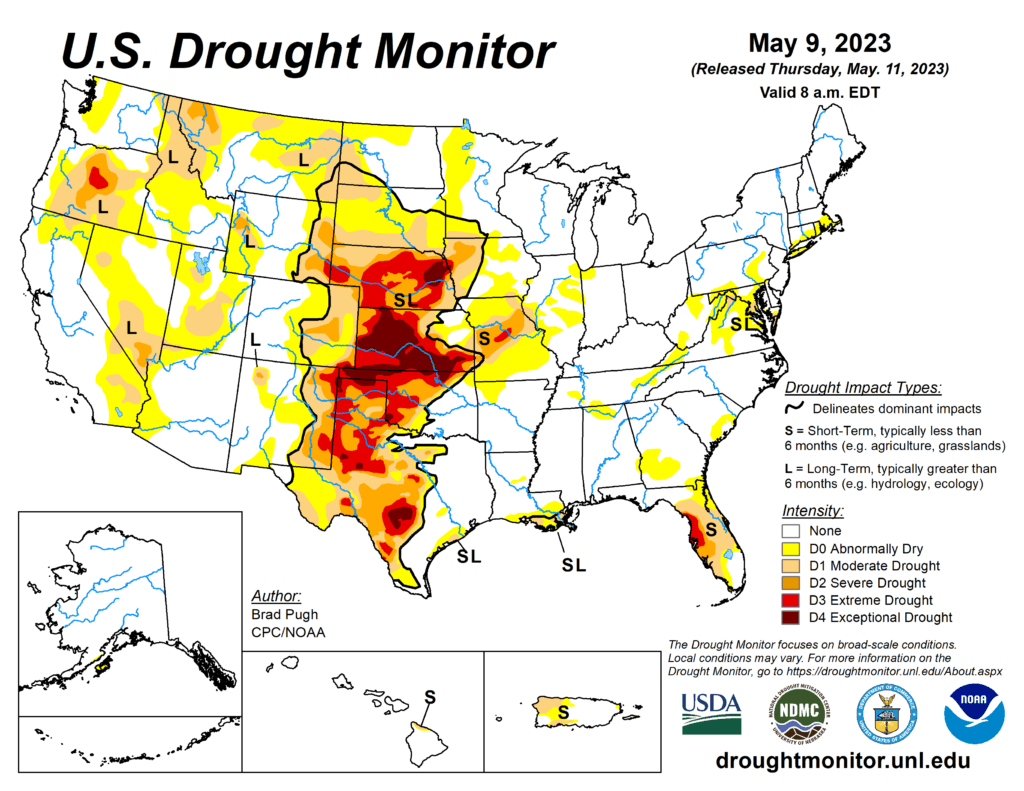
This week’s drought summary
A strong area of mid-level low pressure, near the West Coast, resulted in anomalously wet weather during the first week of May throughout the Pacific Northwest, Northern Rockies, Great Basin, and California. Scattered thunderstorms brought pockets of heavy rainfall (more than 2 inches), from May 2 to 8, to parts of Texas, central Nebraska, and the Midwest. However, much of Kansas, Missouri, and southern Nebraska missed out on this beneficial rainfall. Following a wet end to April across the East, drier weather prevailed this past week from the Mid-Atlantic south to Florida. 7-day temperatures, ending on May 8, averaged below-normal across most of the East along with California, the Great Basin, and Desert Southwest. Weekly temperatures averaged above-normal across the Great Plains.
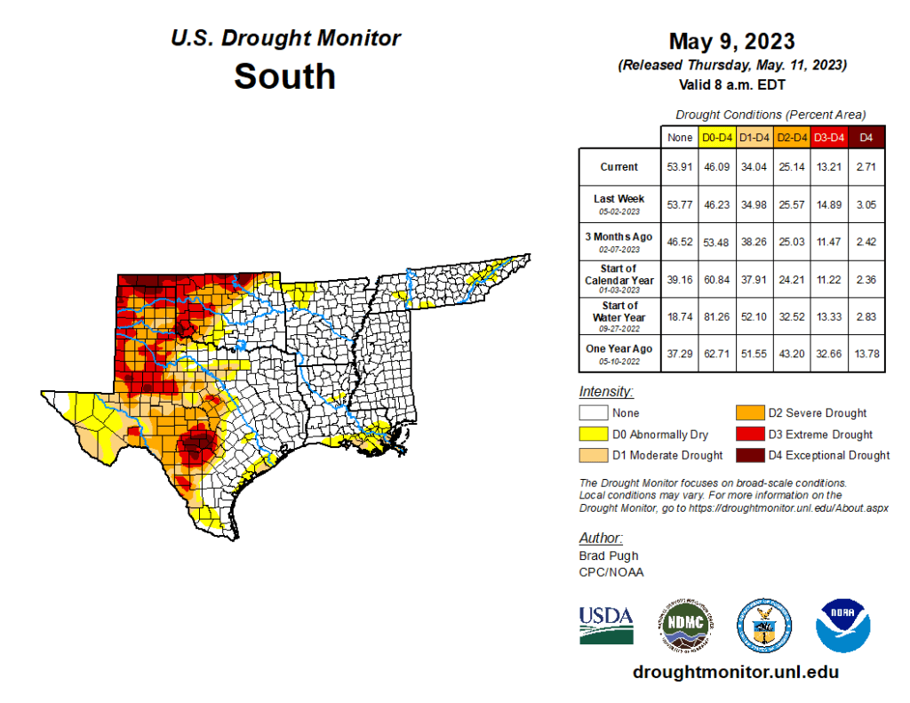
South
A mix of degradations and improvements were made this past week to the Southern Great Plains, western Gulf Coast, Lower Mississippi Valley, and Tennessee Valley. Severe drought (D2) was slightly expanded in southeast New Mexico, based on 90-day SPI and USGS 28-day average streamflows falling below the 10th percentile along parts of the Black River. Based on declining soil moisture indicators, extreme drought (D3) was expanded westward across the Edwards Plateau. More than 1.5 inches of rainfall this past week resulted in a 1-category improvement to parts of central and northwest Texas, the Texas Panhandle, and central Oklahoma. According to NDMC’s long-term objective drought blend, there remains a sharp gradient between extreme to exceptional drought (D3-D4) in northwest Oklahoma to anomalously wet conditions in southeast Oklahoma. An increase in abnormal dryness (D0) was warranted for parts of northwest Arkansas based on increasing 30-day precipitation deficits and 28-day average streamflows below the 30th percentile. The D0 coverage was modified across Tennessee after central parts of the state received more than 1.5 inches of rainfall. However, D0 was expanded to include more of western and northeastern Tennessee, based on 30 to 60-day SPI and 28-day average streamflows. Recent heavy rainfall and 120-day SPI supported elimination of D0 in coastal Mississippi and a slight D0 decrease in southeastern LA. Also, the coverage of moderate drought (D1) decreased across southeastern Louisiana. A small area of D0 was added to central Louisiana where 30 to 60-day precipitation deficits are increasing.