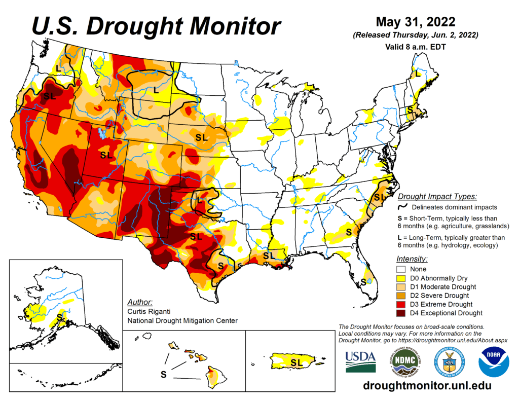
This Week’s Drought Summary
Heavy precipitation fell across much of the contiguous U.S. over the past week, particularly in the Great Plains, Northwest (especially the northern Rocky Mountains), and the Southeast. Much of this fell as rain, though some mountain snows occurred as well. Meanwhile, the Southwest remained dry, along with northern Montana and most of the Texas Panhandle. Improvements to drought conditions were widespread in the Great Plains, with parts of central Kansas seeing two-category improvements to conditions. Despite the widespread precipitation, drought remained in most of the western Great Plains and western U.S., though it lessened in severity in some areas. A mix of worsening and improving drought conditions occurred in the Southeast and Mid-Atlantic states. Long-term drought improved in northern Maine along the Canadian border, while short-term drought expanded in coverage in southern New England. Short-term abnormal dryness and moderate drought developed in south-central and southwest Alaska. Heavy rains in Puerto Rico led to localized improvements there.
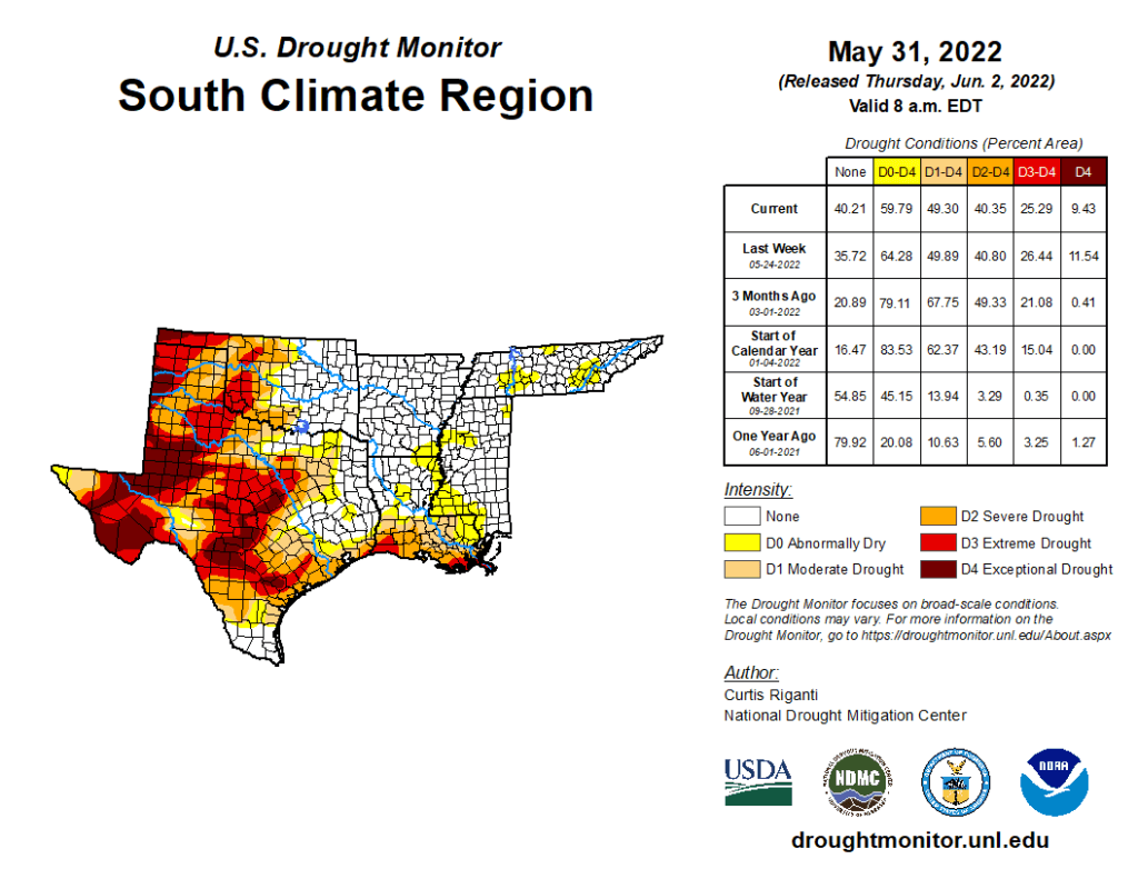
South
Widespread drought conditions continued in western portions of Oklahoma, Texas, southern Texas, and southern Louisiana this week, though some improvements were noted in Texas and Oklahoma. Recent heavy rainfall from far northern Oklahoma into parts of south-central Oklahoma and west-central and central Texas lessened precipitation deficits enough to allow for improved drought conditions. The ongoing drought area over western Oklahoma and the eastern Texas Panhandle is now long-term, reflecting the impact of recent rain events. Tuesday night’s thunderstorms in the Southern Plains was not accounted for on this week’s map, as it fell after the Tuesday morning cutoff. This will be considered for next week’s map. Despite recent rainfall, problems continued with winter wheat and cotton growth in the southern Great Plains. Finally, a small area of short-term drought in southeast Tennessee was removed after heavy rain this week.