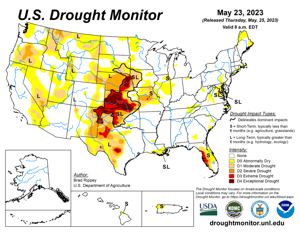
This week’s drought summary
Showery weather across the southern half of the Plains provided additional drought relief, following the previous week’s major storm. Still, much of the rain arrived too late to rescue winter wheat, although rangeland, pastures, and summer crops greatly benefited from the soil moisture improvements. Variable rainfall extended westward into the central and southern Rockies and eastward to the southern Atlantic Coast, maintaining generally favorable growing conditions for pastures and summer crops. Eventually, rain shifted northward along the northern Atlantic Coast, easing dry conditions. Meanwhile, light showers dotted the Northwest, while little or no rain fell across the remainder of the country, including the north-central U.S. and the Far West. A week-long hot spell elevated temperatures in the Pacific Northwest, although temperatures began to fall late in the drought-monitoring period. A separate area of heat, accompanied by high humidity, affected much of the Deep South. Elsewhere, near- or slightly below-normal temperatures prevailed across the central and southern Plains, while cooler-than-normal weather covered much of the Northeast and environs.

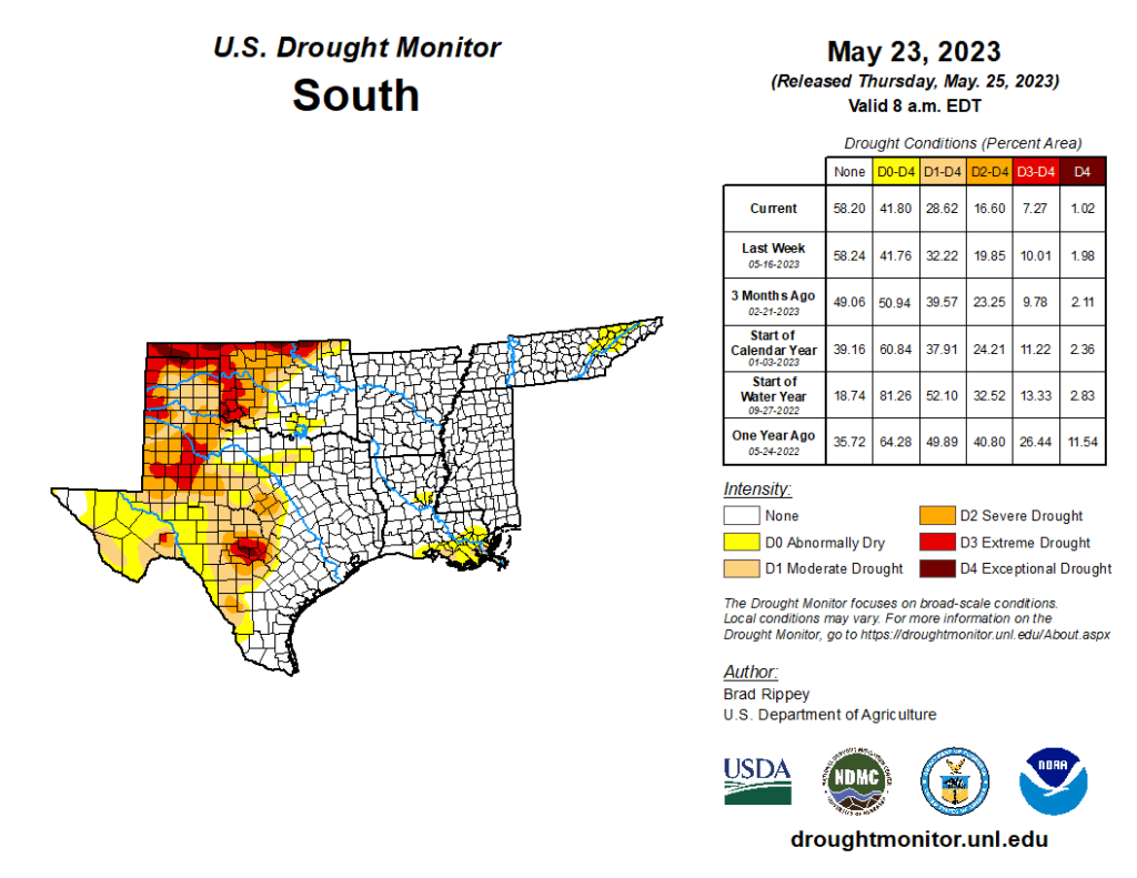
South
Significant drought improvement occurred in some of the hardest-hit areas of Oklahoma and Texas, as rain benefited rangeland, pastures, and summer crops. In Texas, rangeland and pastures rated in very poor to poor condition by the U.S. Department of Agriculture improved from 51 to 36% during the week ending May 21. On the same date, topsoil moisture was rated less than one-third very short to short in Texas (29%) and Oklahoma (28%). Still, even with abundant showers and thunderstorms, pockets of extreme to exceptional drought (D3 to D4) persisted in western and central Texas and across the northwestern half of Oklahoma. Farther east, most areas remained free of dryness and drought, aside from a few areas in the central Gulf Coast region.
