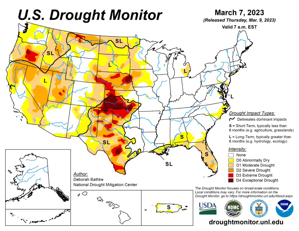
This week’s drought summary
A series of severe weather events moved across the South and Southeast this week, bringing damaging winds, tornados and heavy rainfall. As these storms moved through the Midwest, many locations experienced record daily rainfall. This same storm brought snow to the upper Great Lakes and parts of the Northeast. Precipitation was scarce across other areas of the country, including parts of the West, the High Plains and Deep South. Drought and dryness expanded in parts of the Pacific Northwest, southern Texas and the Gulf and Atlantic coasts. Drought improvements were seen across the West from prior weeks’ precipitation events. In addition, parts of the southern Plains, Great Lakes and mid-Northeast regions also saw improvements.

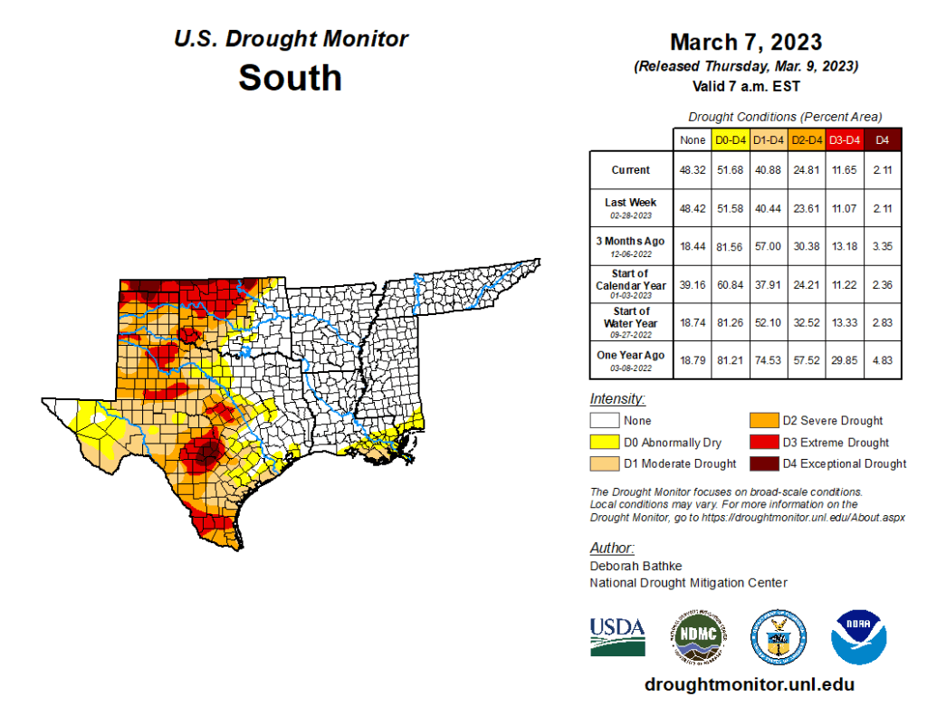
South
Storms brought high winds, tornadoes and heavy rain to parts of the South. A band of heavy rain, over 300 percent of normal (over the last 7 days), fell over drought areas in north-central and central Texas. But, because precipitation is low in Texas this time of year, totals ranged from about 0.5 to 1 inch and provided minimal relief to areas in moderate (D1), severe (D2) and extreme (D3) drought. Longer term deficits remain, and streamflow values quickly returned to below normal over much of the region. Otherwise, most of Texas received little to no rainfall, and many locations experienced an expansion of drought conditions. In the Panhandle, D3 expanded slightly. Precipitation there is less than 25 percent of normal over the last 30 days, and satellite derived soil moisture is very low (5th percentile or less). In South and West Texas, all drought levels expanded as the dry pattern continued. Precipitation in these areas has been less than 10 percent of normal over the last 30 days. The dry weather, combined with temperatures of 3 to 6 degrees above normal, has dried out soils and increased fire danger (as indicated by the Keetch Byram Drought Index). CoCoRaHS observers in South Texas note the lack of measurable rain, cracks in the soil and plants with discoloration and delayed growth. In Oklahoma, 5 to 10 inches of rain fell last week (300% of normal) over the state’s eastern drought boundary. Repeated bouts of moisture have led to short-term improvements overwhelming longer-term deficits, resulting in 1-category improvements. The state climatologist for Oklahoma noted that over half of the reservoirs in the southeast part of the state are now over their conservation pool or close to normal. Meanwhile, short- and long-term drought still have a grip on the northwest part of the state. Dry conditions combined with above normal temperatures and high winds have resulted in several fires.
