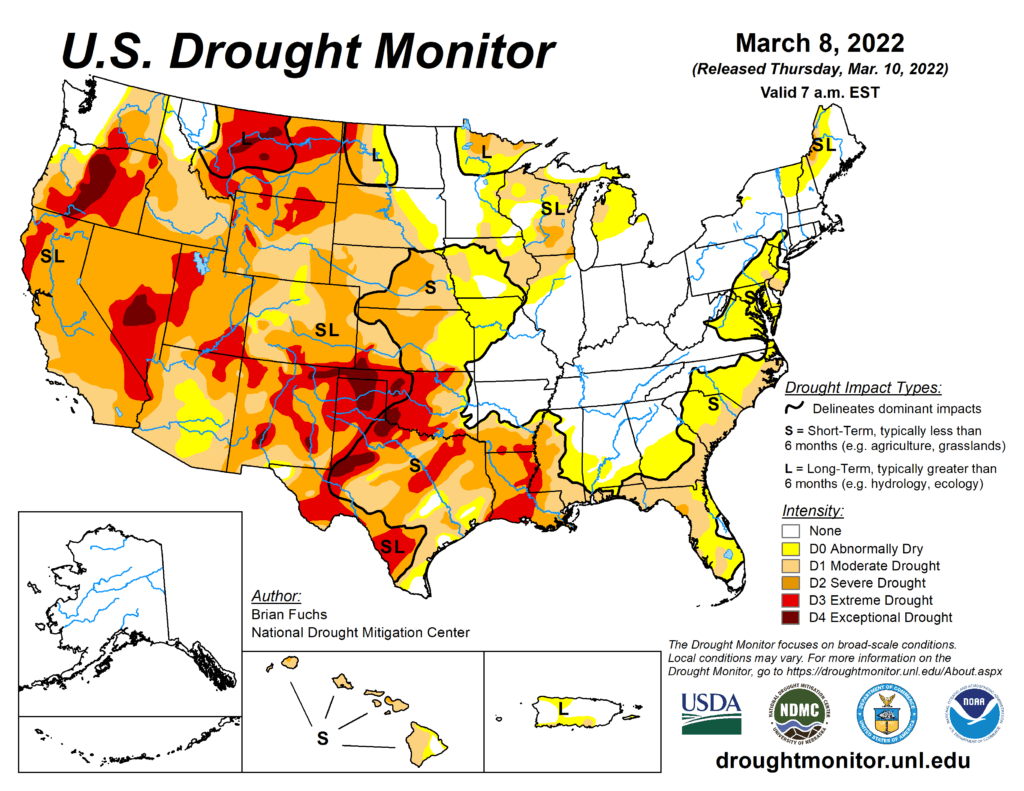
This Week’s Drought Summary
Several storm systems from the northern Rocky Mountains to the Midwest brought with them rain, snow, and even some severe weather this past week. Temperatures for the week were cooler than normal over the northern Plains and into the West. The coldest readings were in the northern Plains and upper Midwest, with departures of up to 9 degrees below normal. Temperatures were warmer than normal over much of the eastern U.S., with the greatest departures (12-15 degrees above normal) over Tennessee and Kentucky. Areas of the Midwest, central Plains and into the West did see above-normal precipitation this week with areas of Kentucky, Indiana, and Ohio receiving over 2 inches of precipitation during the period. The southern Plains and South continue to dry out. As spring approaches and dormancy is broken, impacts are already showing in these areas and drought intensification is widespread with quickly expanding extreme and exceptional drought areas.
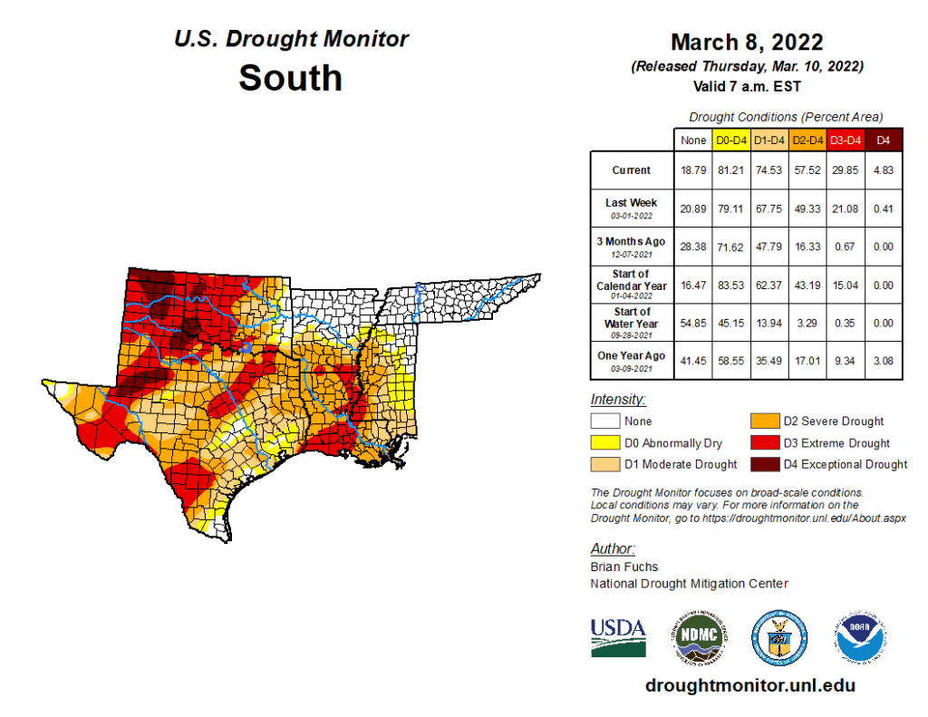
South
Temperatures were warmer than normal over most of the region, with departures of 9-12 degrees above normal over Tennessee. Areas of northern Oklahoma and Arkansas experienced the only precipitation events in the region with above-normal amounts as most all of the region was quite dry. Degradation continued with drought status over the region. As dormancy breaks and green-up begins, water demand has increased along with warmer temperatures. Exceptional drought was expanded to cover more of the Oklahoma and Texas panhandles. Severe drought was expanded over western Oklahoma along with a new pocket of exceptional drought. A full category worsening of drought conditions took place over west Texas and much of central and east Texas as severe and extreme drought expanded. Mississippi and Louisiana also had widespread degradation with extreme drought expanded over most of southern Louisiana and along the Mississippi River into Mississippi. Moderate and severe drought were also expanded over much of central Mississippi and into southeast Louisiana. The overall pattern from the southern Plains into the South has been dry and warm conditions that will only lead to worsening conditions as spring arrives. The 4-month period from November to February was the 2nd driest such period for Louisiana since 1895 with less than 10 inches of observed precipitation statewide. With some good rains in Louisiana after the data cutoff for consideration this week, there may be some opportunities for improvements next week where the greatest rains occur.