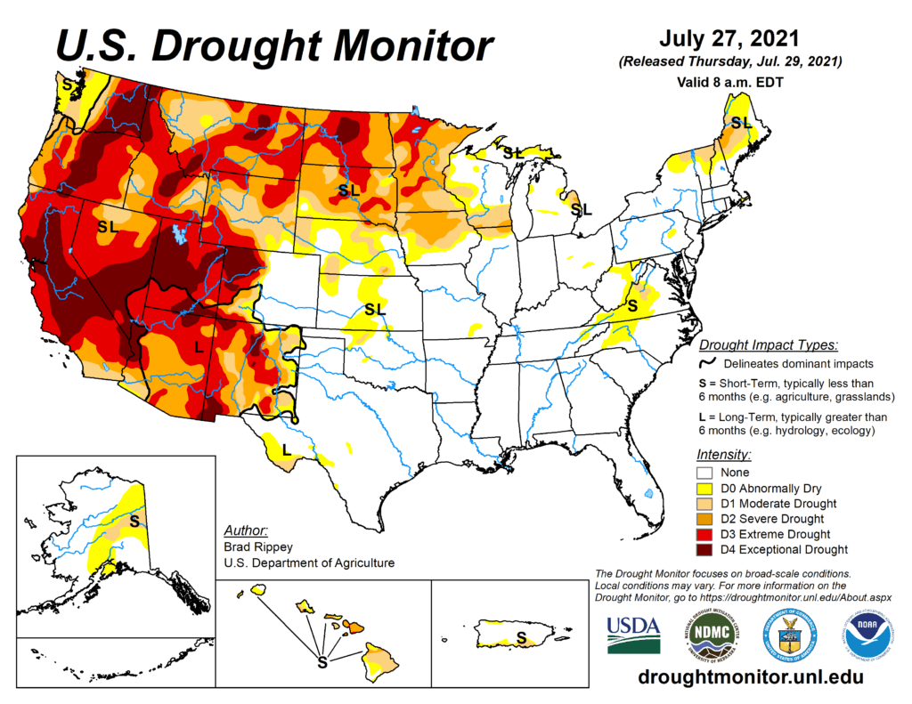
This week’s drought summary
A robust Southwestern monsoon circulation delivered drought-easing rainfall but sparked localized flash flooding across large sections of the Four Corners States, as well as the southern Great Basin, but critically dry conditions persisted across northern California and the Northwest. In the driest areas, wildfires—some sparked by lightning—dotted the landscape, with containment of some blazes hampered by high temperatures, low humidity levels, erratic winds, and abundant fuels. Farther east, another round of blistering heat across the northern Plains further stressed rangeland, pastures, and a variety of summer crops. The central and southern Plains also experienced some hot weather, although agricultural impacts were tempered by mostly adequate soil moisture reserves. Meanwhile, mostly dry weather covered the Midwest, continuing a trend that had developed in mid-July. Short-term dryness was not yet a concern in the previously well-watered lower Midwest. However, reproductive corn and soybeans in drier areas of the upper Midwest were subjected to increasing levels of stress, especially as temperatures began to rise. Elsewhere, Southeastern rain—which maintained abundant moisture reserves for pastures and summer crops—primarily fell from the Mississippi Delta to the southern Atlantic Coast.
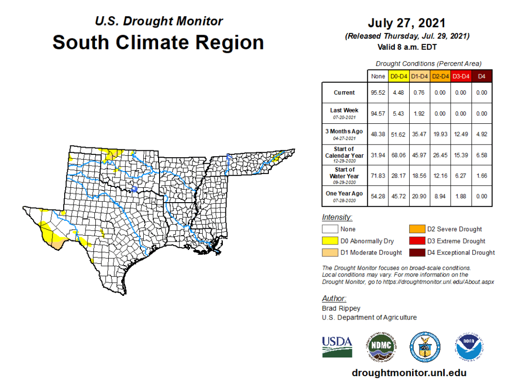
South
Arkansas, Louisiana, and Mississippi remained free of dryness and drought, while only small patches of abnormal dryness (D0) and moderate drought (D1) were noted in Oklahoma, Texas, and Tennessee. Most Southern crops continued to fare well amid plentiful rainfall and relatively mild temperatures. On July 25, three-quarters (75%) of the nation’s peanuts were rated in good to excellent condition, according to the U.S. Department of Agriculture, along with 73% of the rice and 61% of the cotton.