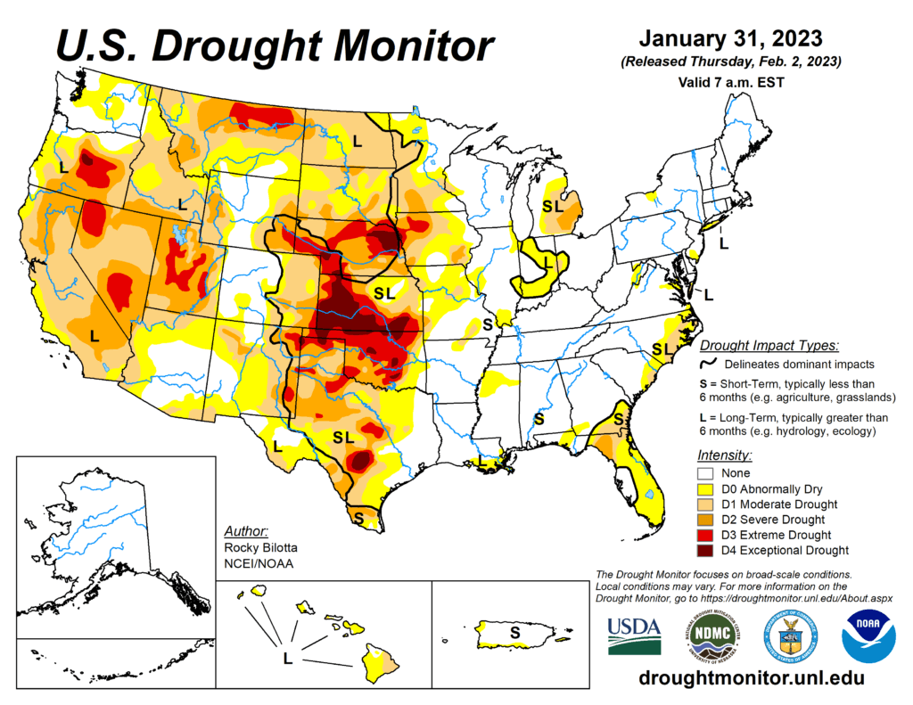
This week’s drought summary
Winter storms brought heavy rain and snow much of the eastern U.S. and from the Pacific Northwest to the central Rockies this week with above-normal precipitation observed from the southern Plains to the Southeast and along the East Coast. Precipitation led to abnormal dryness and drought improvements in the central Plains, Midwest, Southeast and Northeast. Conversely, conditions worsened over dryer areas including Idaho/Montana, southern Texas and the Florida Panhandle. In the eastern United States, temperatures have been above-normal resulting in rain falling over many areas instead of snow. Many cities including New York, Baltimore, Philadelphia and Washington D.C. remain snowless for the season. New York City recently set a new latest first measurable snowfall previously set on Jan 29, 1973. In California, a series of atmospheric rivers brought significant amounts of rain which gave reservoirs a much-needed boost, but California lacks infrastructure to make use of such a massive rainfall. Despite the deluge, the winter storms may not have eased the state’s drought. In Hawaii, a strong low pressure system aloft combined with a low pressure trough at the surface to produce conditions favorable for heavy rainfall and flash flooding over portions of the main islands.

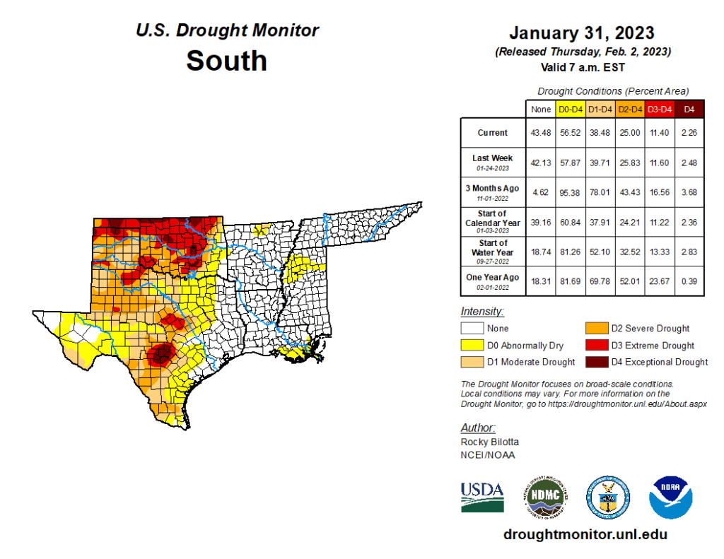
South
A half an inch or more of precipitation fell across much of the South with the heaviest amounts falling across the eastern part of the region. Two inches of more of rainfall fell across parts of eastern Texas, Arkansas, Louisiana and Mississippi, which resulted in moderate to exceptional (D1-D4) drought and abnormal dryness (D0) improvements in Oklahoma; moderate to extreme (D1-D3) and abnormal dryness improvements in eastern Texas; and abnormal dryness improvements in Arkansas, Louisiana and Mississippi. Conversely, drought and abnormal dryness was expanded in western Texas due to lack of rain, precipitation deficits, drying soils and degrading streamflow in the area.
