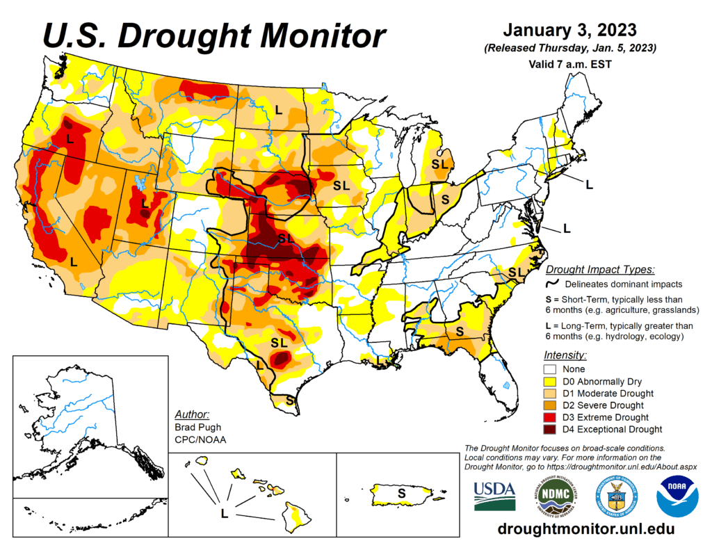
This week’s drought summary
An atmospheric river (AR) led to heavy rain and high-elevation snow across the West with the largest amounts throughout California on December 30 and 31. Preceding this AR, enhanced onshore flow also resulted in widespread rain and high-elevation snow from the West Coast eastward to the Continental Divide. 7-day total amounts (liquid equivalent), from December 27, 2022 – January 2, 2023, ranged from 2 to 6 inches (locally more) across much of California, western Oregon and Washington, and parts of the Great Basin and central Rockies. A pair of low pressure systems brought widespread, heavy rainfall (1 to 3 inches, locally more) from the lower Mississippi Valley northward to the Ohio Valley. A winter storm affected southern South Dakota and western to central Nebraska where 6 to 18 inches of snowfall occurred on January 2. Mostly dry weather prevailed along most of the East Coast and southern Great Plains. Following the Arctic air outbreak during late December, a rapid warming trend began during the final days of 2022. 5-day temperatures (December 27, 2022 – January 2, 2023) averaged more than 10 degrees F above normal across the central and eastern U.S.

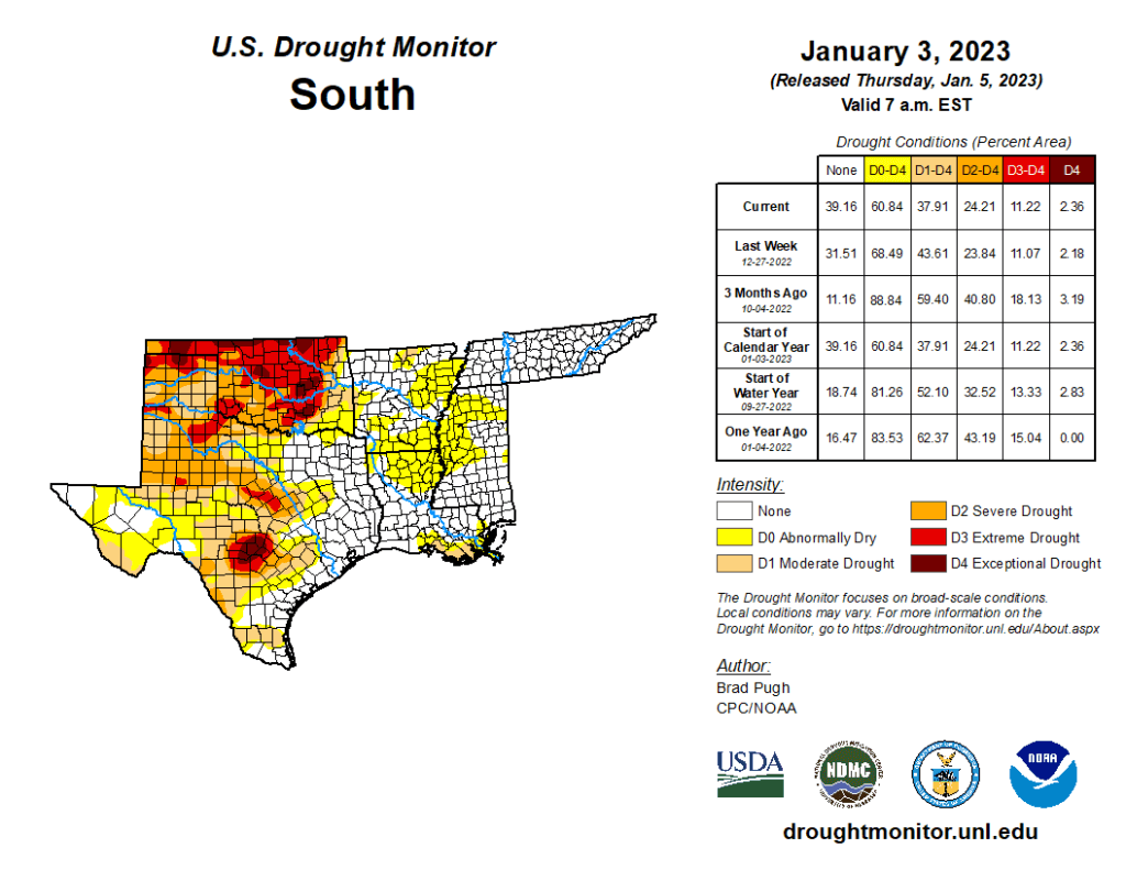
South
Widespread heavy rainfall (2 to 6 inches) resulted in a broad 1-category improvement to the lower Mississippi Valley and eastern Texas, which makes much of these areas drought-free. Degradations made to central and southern Texas were based on SPI at various time scales and 28-day streamflow. Following a dry week, much of Oklahoma and northwestern Texas remain designated with severe (D2) to exceptional (D4) drought.
