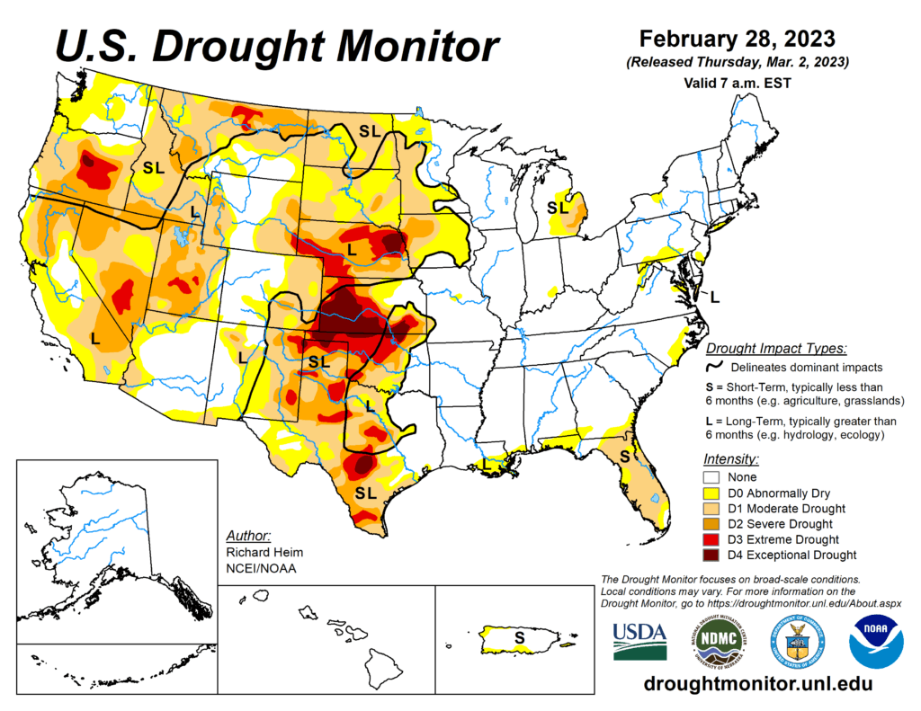
This week’s drought summary
A series of Pacific low pressure and frontal systems moved across the western contiguous U.S. (CONUS) during this U.S. Drought Monitor (USDM) week (Feb. 22-28). The weather systems dropped copious amounts of rain and snow across the West, especially over the Sierra and coastal ranges and Rocky Mountains. The weather systems re-intensified as they crossed the Plains and into the Midwest, tapping Gulf of Mexico moisture to spread several inches of rain over northeast Texas to the Appalachians and Ohio Valley, with several inches of snow falling in the below-freezing air across the northern tier states from the Dakotas to New England. A high-pressure ridge over the Gulf of Mexico generated a southerly flow that spread warmer-than-normal air from the Gulf Coast to southern Great Lakes. It also pushed the low-pressure systems along a storm track that went northeastward from the southern and central Plains to the Great Lakes. Temperatures averaged cooler than normal across the snowy northern states, across the central to northern Plains, and over the West. Little to no precipitation fell across the Gulf Coast, western portions of the southern and central Plains, and over the northern Plains near the Canadian border. It was also drier than normal over parts of the Pacific Northwest, northern New England, and the Mid-Atlantic states. Wetter-than-normal conditions were widespread across the rest of the West, parts of the northern and central Plains and Northeast, and much of the Midwest. Drought or abnormal dryness expanded where it continued dry in parts of Texas, Florida, and other Gulf Coast states. Drought or abnormal dryness contracted or reduced in intensity where it was wet across much of California and other parts of the West and Plains, as well as part of the Great Lakes region.
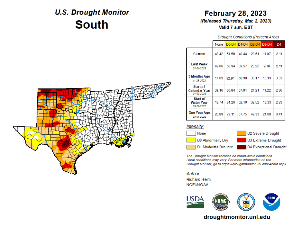
South
Two inches or more of precipitation fell in strips across Arkansas and eastern Oklahoma, with half an inch or more stretching from northeast Texas to Tennessee. But little to no precipitation fell across western and southern areas of the region. Abnormal dryness and moderate to extreme drought were trimmed in parts of eastern Oklahoma and north-central Texas, but abnormal dryness expanded along the Gulf Coast in Louisiana and Mississippi. Abnormal dryness and moderate to extreme drought expanded in parts of the southern half of Texas as streamflow, soil moisture, and groundwater continued at very low levels. High winds, low humidity, and hot temperatures continued to dry out the soils. Two years of drought in the southern Plains were capped this week by raging dust storms. The continued dry weather, and now 100+ mph winds with low humidity, have desiccated crops, with the media reporting that the dryland wheat crop in parts of Texas, Oklahoma, and Kansas could see abandonment rates up to 80%.