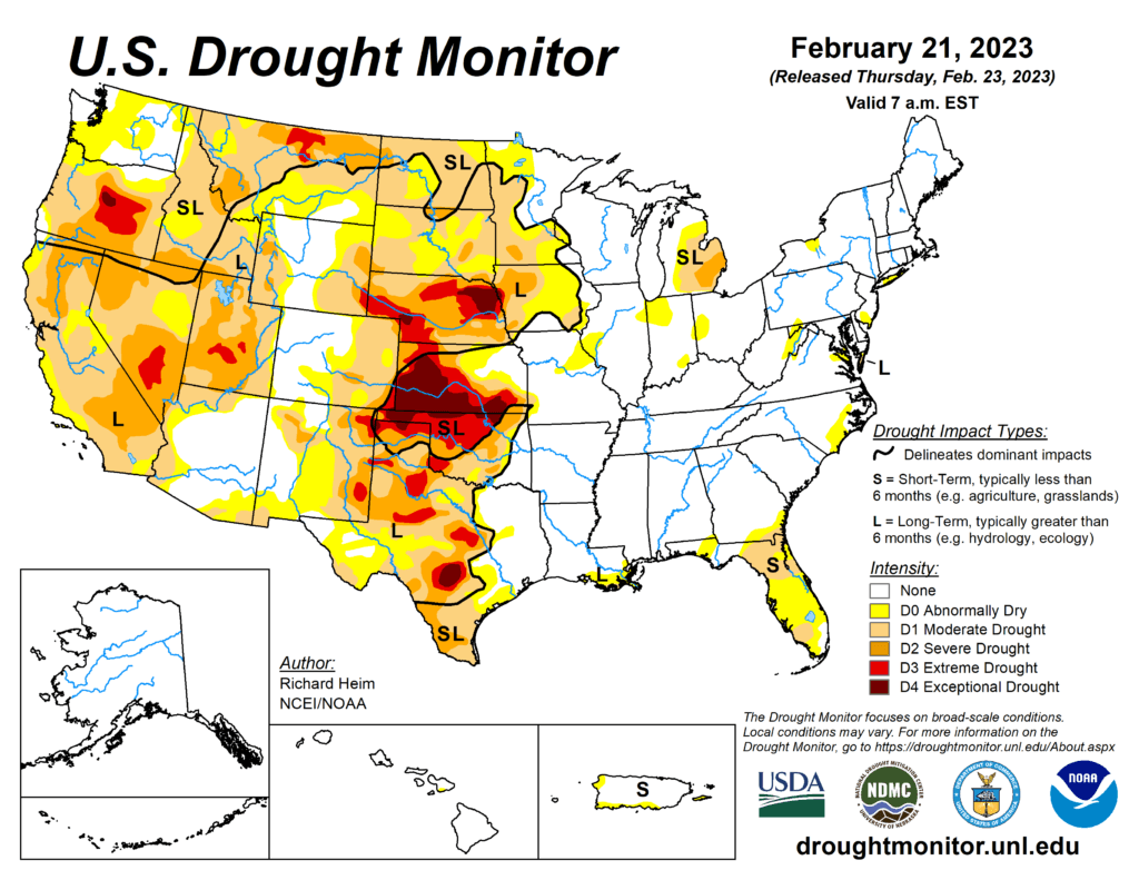
This week’s drought summary
An upper-level ridge over the northeastern North Pacific Ocean deflected Pacific storm systems away from the West Coast of the contiguous U.S. (CONUS) during this U.S. Drought Monitor (USDM) week (February 15-21). This resulted in a generally drier-than-normal week over much of the West. An upper-level trough developed over the western CONUS downstream from the ridge, and the trough was responsible for a cooler-than-normal week over the West. Strong high pressure over the Gulf of Mexico extended into a ridge across the East Coast. A southerly flow between the trough and eastern ridge spread warm, moist air from the Gulf of Mexico across the eastern CONUS and directed weather systems northeastward from the southern Plains to Great Lakes. Two weather systems early in the week generated above-normal precipitation across parts of the central to eastern CONUS. As the week ended, weather systems moved across the northern tier states, bringing areas of snow. The week was wetter than normal across parts of the northern Rockies, from the Four Corners states to western Great Lakes, and from the central Gulf Coast states to Ohio Valley and Mid-Atlantic states. It was a drier-than-normal week across much of the West, southern Plains, coastal Southeast, and southern Great Lakes to New England, and parts of the northern to central Plains. Drought or abnormal dryness expanded where it continued dry in parts of the Pacific Northwest, southern Plains, and Florida. Drought or abnormal dryness contracted or reduced in intensity where it was wet over parts of the Four Corners area, southern and central Plains to Upper Mississippi Valley, and the Big Island in Hawaii.

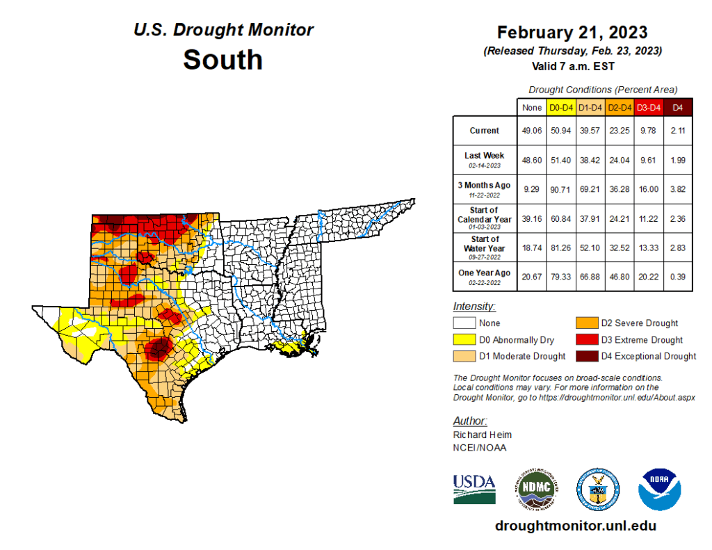
South
Two inches or more of precipitation fell across eastern portions of the South region, specifically parts of Mississippi and much of Tennessee. Half an inch or more occurred from there to eastern Oklahoma and northeast Texas. For the rest of Oklahoma and Texas, the week continued a dry pattern. Abnormal dryness and moderate to extreme drought contracted in eastern Oklahoma, due to wet conditions this week and previous weeks and improved soil moisture and streamflow conditions, and abnormal dryness contracted in northeast Texas. But extreme to exceptional drought expanded in western Oklahoma and the Texas panhandle, while abnormal dryness and moderate to severe drought expanded in parts of southern Texas along the coast and along the Rio Grande River where streamflow and soil moisture conditions deteriorated and precipitation deficits continued to grow. According to media reports, 80-mph winds created a dust storm in the Oklahoma panhandle that caused a multiple car pileup, killing a driver.
