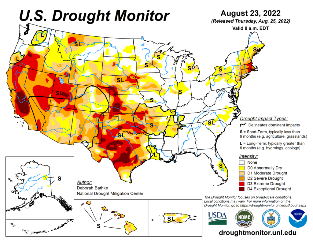
This Week’s Drought Summary
Record-breaking rainfall led to aggressive improvements in drought conditions across parts of the South. The heavy rainfall and flooding led to communications outages at the National Weather Service office leaving climatologists without access to important data and tools needed to fully analyze the effect of this event. The magnitude of this event meant prioritizing improvements on this week’s map in these areas and in the Southwest, where the Monsoon season remains active. Drought expanded in the Northwest was warm, dry conditions continued across the region. The Midwest, Southeast, and Northeast saw a mix of improvements and degradations.
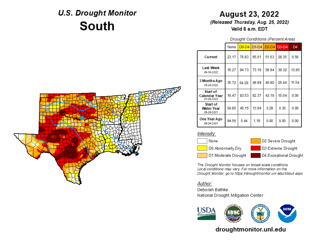
South
This week’s storm event led to broad 1 and 2-category improvements across large parts of the South. All states in the region show improvements. Rainfall close to the data cut off time (Tuesday at 8:00 a.m. EDT), data communications issues caused by the flooding, and lags in the hydrologic system in response to rainfall events means that the full impact of this storm on drought conditions is not yet apparent. Analysis will continue next week as more data become available. A few impressive statistics include the following. According to National Weather Service records, prior to this week’s event, the Dallas-Fort Worth Area went 67 days without measurable precipitation, the second longest streak on record going back to 1898. The August 21-22, 24-hour total of 9.19 inches tied for the second highest 24-hour total. The Texas State Climatologist noted that the largest flood control rain gauge total was 15.16 inches!