This week’s drought summary
Dry conditions dominated the West and southern Plains, coupled with above-normal temperatures. Precipitation was most widespread throughout much of the upper Midwest and central Plains and into the Northeast. Almost the entire country had near- to above-normal temperatures this last week, with the greatest departures over the Southwest and central Plains where temperatures were at least 4-7 degrees above normal. Cooler-than-normal temperatures were recorded in the Pacific Northwest with departures of 3-6 degrees below normal. At the end of the current U.S. Drought Monitor period, significant rains developed over portions of the Midwest and central Plains, and they will be accounted for in the next analysis.

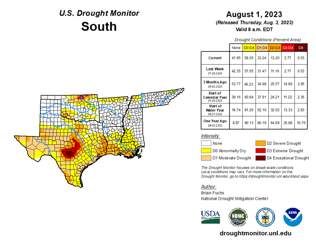
South
Temperatures were near normal to slightly above over most of the region, with the greatest departures from normal in west Texas and the Texas and Oklahoma panhandles, where departures were 4-6 degrees above normal. It was an incredibly dry week over the region with only a few pockets of showers over northern Arkansas and coastal areas of Texas. Most of the region recorded zero precipitation for the week. Severe drought expanded over east Texas and southern Louisiana and a new area of severe drought was introduced over far west Texas. Moderate drought expanded over southwest Oklahoma and northern Texas.
