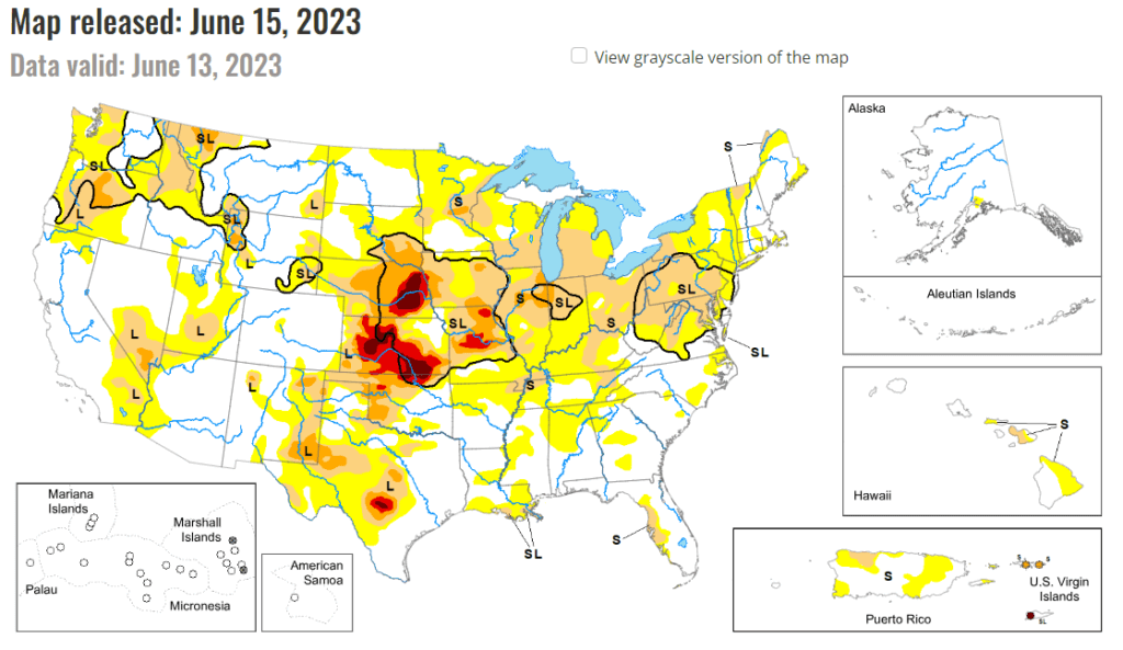
This week’s drought summary
Above normal precipitation and below normal temperatures resulted in another week of targeted improvements across portions of the Intermountain West, adding to recent precipitation totals that have continued to improve long-term drought conditions. The exception is the Pacific Northwest, where below normal precipitation and above normal temperatures resulted in worsening drought conditions along the northern Cascades. There is a mix of improving and worsening drought conditions across the Great Plains. Improvements are mainly confined to the western Great Plains, where widespread 7-day rainfall totals exceeded 200 percent of average for the week, further adding to short-term precipitation surpluses. From the eastern Great Plains to the Eastern Seaboard, 7-day rainfall surpluses are more scattered in nature, leading to only modest improvements in areas seeing the heaviest amounts. In areas that received below normal rainfall this week, drought worsened, as rainfall deficits continue to increase.

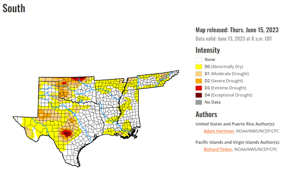
South
Several locations across Louisiana, Mississippi, and Tennessee experienced degradation this week, as the frontal boundary draped across the southern tier states did not result in enough precipitation to stave off degradation for those experiencing antecedent dryness. This is also the case in portions of central Texas and parts of the middle Red River basin, where targeted degradations are also warranted. However, farther westward across western portions of the Southern Plains, pockets of heavy rainfall continued to add to 60-day precipitation surpluses, particularly for parts of the Texas and Oklahoma Panhandles. Rainfall has been plentiful in these areas in recent weeks and months. For example, Amarillo Texas recently set a new record of 20 days with measurable precipitation during May; the previous record being 15 days. In addition, Lake Meredith, located north of Amarillo has reached 45.8 percent of its capacity, its highest since 2001, according to Texas Water Development Board data.
