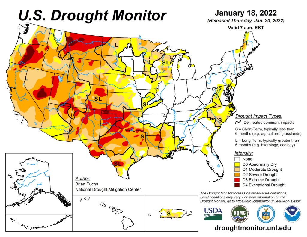
This Week’s Drought Summary
A winter storm impacted areas from the northern Plains, to the Midwest, into the Southeast and then up the east coast during the period. For many areas, this was the first time that heavy snow occurred in these regions as many have brought up “snow drought” in areas of the country where snow has been minimal. From the Missouri River west, there was very little precipitation for the week. Temperatures were warmest over the northern Rocky Mountains and Plains where departures were 10-15 degrees above normal. Cooler temperatures dominated the East as departures were 5-10 degrees below normal.

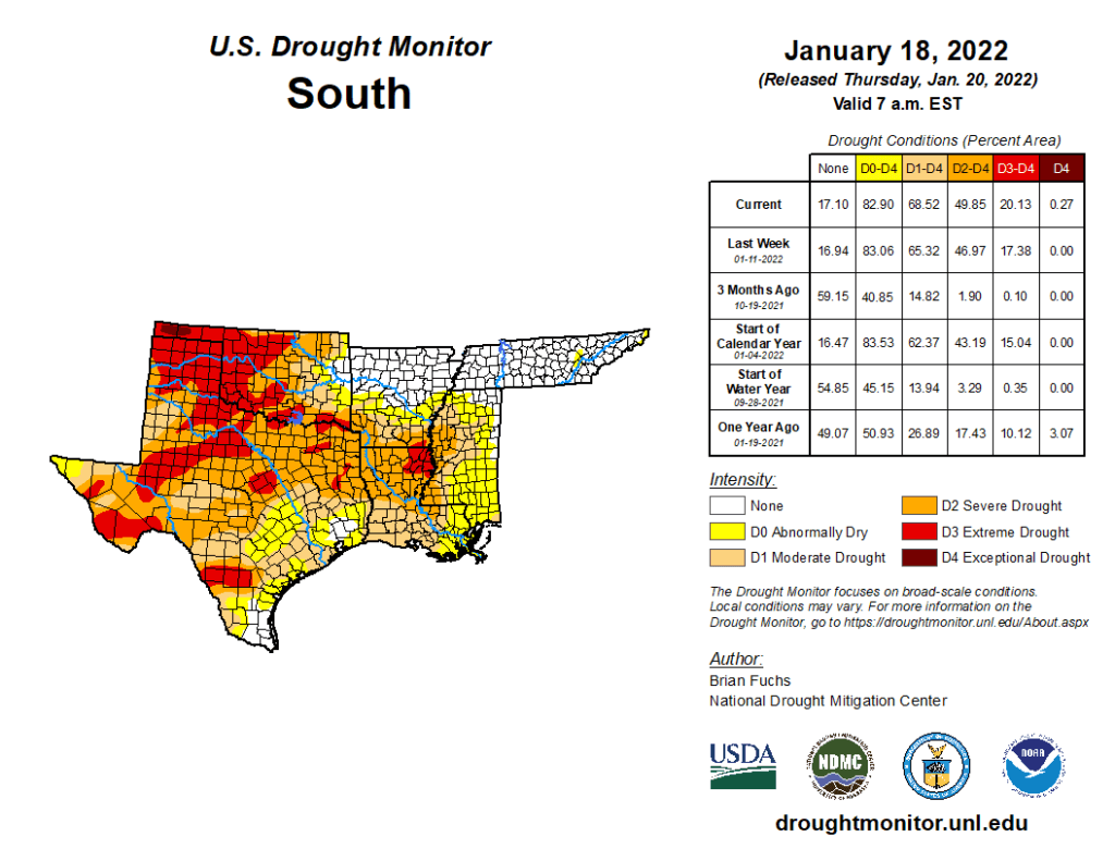
South
Most of the region was dry for the week with only portions of northern Arkansas, Tennessee, and Mississippi recording widespread precipitation, with some areas at 150% of normal or more. Temperatures were near normal to slightly above with departures of 2-4 degrees above normal over the panhandles of Texas and Oklahoma as well as eastern Arkansas. Coastal areas of Texas into the Delta were 2-4 degrees below normal. Degradation continued as most areas have been dry since the fall and temperatures have remained well above normal during this period. In Oklahoma, a new area of exceptional drought was added in the panhandle with extreme drought areas expanded to the east. Severe drought expanded in southern Arkansas and into Louisiana and Mississippi. For Texas, severe and extreme drought expanded in the central and northern portions of the state while moderate and severe drought expanded in south Texas. There was an improvement to moderate drought and abnormally dry conditions in east Texas.

