This week’s drought summary
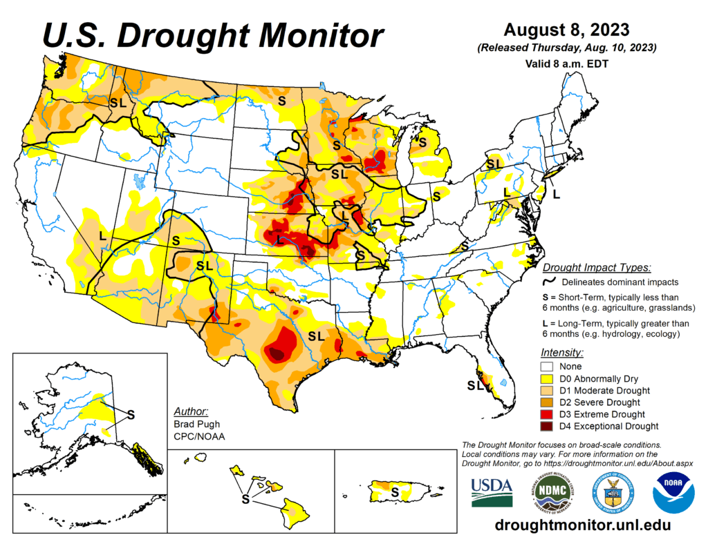
A strong area of mid-level high pressure, anchored over the southern tier of the country, continued to promote above-normal temperatures and mostly dry weather across the Rio Grande Valley, Texas, and the lower Mississippi Valley. Weekly temperatures (August 2 to 8) averaged more than 6 degrees F above normal across portions of Louisiana, Texas, and southern New Mexico. The persistence of this pattern led to rapidly developing and intensifying drought across Texas and the lower Mississippi Valley. The Monsoon remains suppressed with increasing short-term drought across Arizona, New Mexico and southwest Colorado. Frequent rounds of heavy rainfall occurred from the central Great Plains southeastward to the middle Mississippi Valley. During the first week of August, parts of Missouri received 5 to 10 inches (locally more) of rainfall. The wet start to August resulted in improving drought across parts of the Corn Belt. Farther to the north, drought continues to intensify across Wisconsin. On August 7, a severe weather outbreak with heavy rainfall affected the East. Short-term drought expanded this past week across parts of the Hawaiian Islands.

South
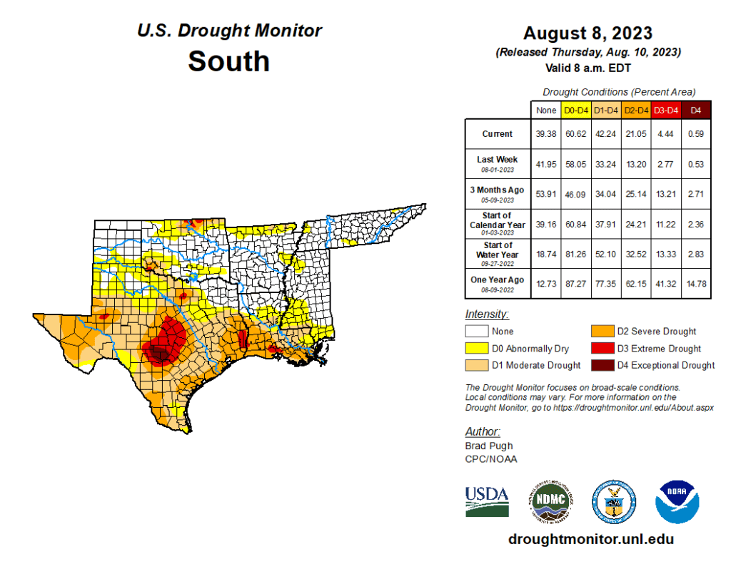
Increasing 30 to 60-day precipitation deficits coupled with excessive heat and high evapotranspiration rates support a widespread 1-category degradation across Texas, Louisiana, and southwest Mississippi. 30 to 60-day SPI/SPEI, NDMC’s short-term blend, and soil moisture were leaned on for these degradations. During the past two months, temperatures have averaged 2 to 6 degrees F above normal across parts of Texas and Louisiana. Heavy rainfall (more than 2 inches) resulted in a 1-category improvement to northern and eastern Oklahoma along with parts of Tennessee.
