Livestock Wx for Jan. 8, 2021: More Snow for West Texas and a Change in the Polar Vortex
Snow this Weekend
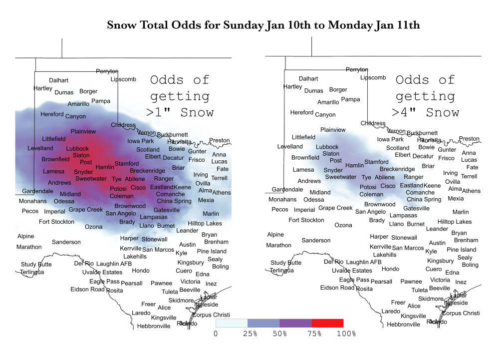
An upper-level disturbance will travel from the Rocky Mountains into Texas this weekend. As a result, more snow is expected over a relatively large part of West Texas. How the storm will unfold and the exact track it will take is still uncertain, but the area could see some decent snowfall. The map on the left below shows strong odds of at least 1” of snow falling in the 24-hr. period between Sunday and Monday. At the center of the storm, there are better than 50/50 odds of getting more than 4” (map on the right). The area that has a chance of getting 4” of snow or more covers approximately 500,000 head of cattle and calves.

Change in the Polar Vortex
In other news, we are starting to see signs that the Polar Vortex could be weakening, which could allow very cold Artic air southward into the U.S. It’s not exactly clear or for how long this could happen, but we could see an outbreak in the next couple of weeks.
The Polar Vortex is an air mass that circulates counterclockwise around the North Pole. Warm air in the stratosphere can disrupt the Vortex, which can cause the release of normally bottled-up cold air to push much further south into North America, Europe and Asia. We are seeing signs of warming in the stratosphere so there is an expectation that the Polar Vortex could become “wobblier” thus releasing much colder air making it more possible to have extreme weather such as large snowstorms. The current outlooks are not necessarily able to take this into consideration, so it is something to be aware of as we progress through January.
