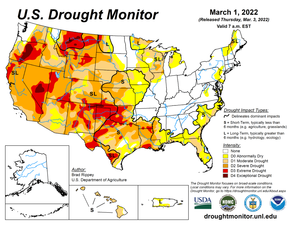
This Week’s Drought Summary
The drought-monitoring period, which began on the morning of February 22 and ended early March 1, featured some wild temperature swings, along with a band of heavy precipitation stretching from the mid-South into the Northeast. In fact, this represented the second consecutive monitoring period with significant precipitation along nearly the same axis, while many other parts of the country received little or no moisture. As a result, gradual expansion of dryness and drought was the rule across much of the western half of the nation, extending into parts of the upper Midwest, as well as the southern Atlantic States and the Gulf Coast region. In contrast, heavy precipitation kept drought at bay from the Ozark Plateau into the Ohio and Tennessee Valleys and the lower Great Lakes region. Significant precipitation also fell in drought-free areas of the Pacific Northwest, leading to another round of flooding in parts of western Washington.

South
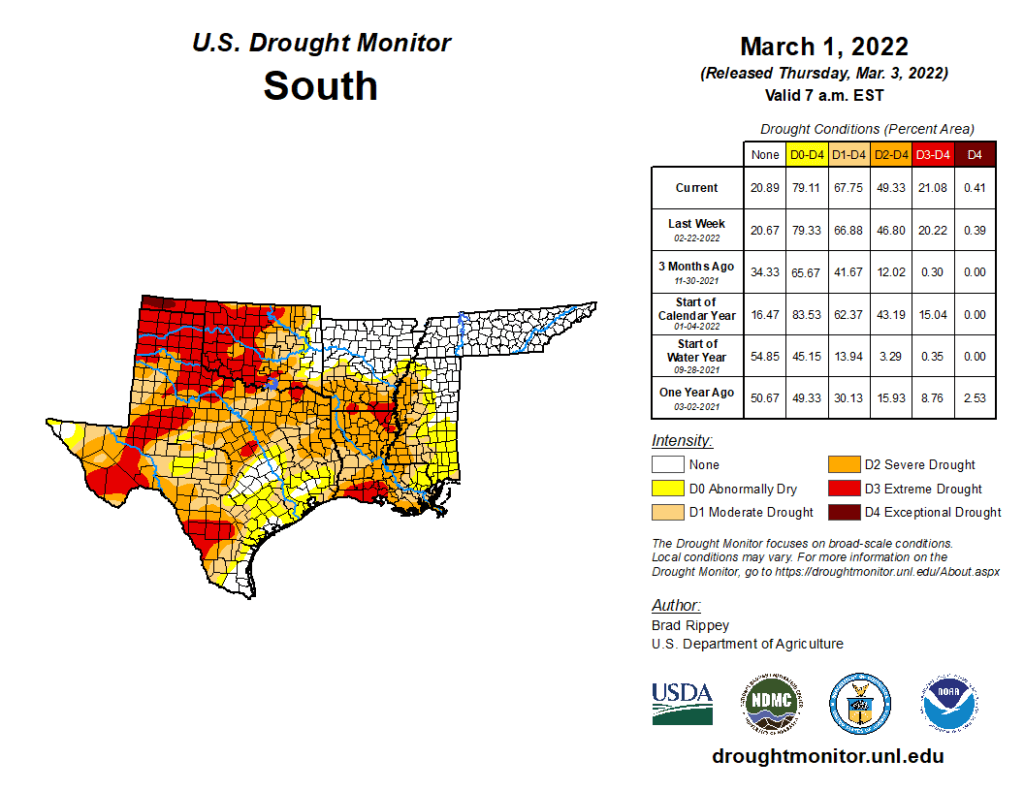
For the second week in a row, a sharp contrast existed between heavy precipitation in the mid-South and mostly dry weather closer to the Gulf Coast and across the southern Great Plains. That pattern, consistent with La Niña, helped to sharpen the drought gradient across Arkansas and Mississippi. Meanwhile, extreme drought (D3) was expanded in several areas, including southwestern Louisiana. Winter (December-February) rainfall totaled just 5.18 inches (39% of normal) in New Iberia, Louisiana, and 3.94 inches (29%) in Beaumont-Port Arthur, Texas. On February 27, statewide topsoil moisture in Texas and Oklahoma was rated at least three-quarters very short to short, according to the U.S. Department of Agriculture. On that date, winter wheat was rated 75% very poor to poor in Texas, along with 65% in Oklahoma. Texas also reported 69% of its rangeland, pastures, and oats were rated very poor to poor. Burn bans were in effect for dozens of counties across Texas, as well as western and central Oklahoma.

